Showing posts with label Tongariro Alpine Crossing. Show all posts

Saturday, 10 February 2018

Tongariro Alpine Circuit - Stats & Maps

Nothing massively surprising came out of my maps for the Tongariro Circuit. I did a few less steps than I expected most days, but otherwise was quite happy with the walk.

Day ONE - Every km had some uphill, ranging from 17m in the 5th kilometer to 79m in the 2nd (which was also our slowest). Our fastest section was the last 600m to the hut, which is unsurprising, given this was the point where we came off the clay gully and onto the immaculately manicured Tongariro Alpine Crossing track. The going here was often slower than the terrain would suggest as the walking required careful consideration to avoid unkempt track.
Fitbit: 26,351 steps
MapMyWalk: 8.64km, 202m gain, 11,751 steps while walking, 10,895kJ 
DoC: 8.5km 

Day TWO - It honestly looks like we ran out of puff just before crossing into South Crater - it took us an HOUR to complete km 5. What it doesn't show is that we stopped to take some night photos, and didn't stop the tracker while we did. We were running out of puff a little by then though, having done over 2 hours all uphill with no breakfast and on about 3 hours sleep. Our next slowest km was the final climb to the top, where we did hit the wall. That was hard. The biggest climb was in the 4th km, at 213m. It is easy to pick where we got down off the lava flows and onto the better track, as our pace speeds up significantly.
Fitbit: 30,796 steps
MapMyWalk: 12.08km, 629m gain, 16,432 steps while walking, 20,707kJ
DoC: 12.8km (8km Mangatepopo to Emerald Lakes, 4.8km Emerald Lakes to Oturere)

Day THREE - Turns out, there's quite a climb between Waihohonu and Whakapapa. It actually didn't feel that bad, especially after the short, sharp, up and over we did to get to Waihohonu in the first place. It is completely unsurprising that that section was both our slowest, and our biggest single-km climb, with the climb being nearly perfectly 1km, and 143m. Distances are a little out on this day as I had to use my iPhone, which tends to add in unnecessary loops, creating extra distance, but also increasing speed.
Fitbit: 43,159 steps
MapMyWalk: 25.35km, 496m gain, steps not suggested, 21,569kJ
DoC: 21.8km (7.5km Oturere to Waihohonu huts, 14.3km Waihohonu to Whakapapa)

Exemplar iPhone loops at Waihohonu

Exhaustion level: Epic


Tongairo Northern Circuit, Great Walk. Whakapapa Village to Whakapapa Village.
Party: Marion, Me
03 – 05 February 2018

Halfway up the Devils Staircase, under the light of the ¾ moon, at about 4:30am on Sunday morning, Marion commented to me that I was probably the only friend she had crazy enough to not only do, but suggest, such a trip. I think she meant it as a compliment.

Track, Whakapapa - Mangatepopo
After dropping off our town clothes and after-tramping food at the club lodge at Iwikau, we nabbed a carpark in the village, threw on rain gear and headed off on the “least maintained track in the National Park” (DoC Visitor Centre Rangers own words). With reasonable weather, we made it across to Mangatepopo Hut in good time. The track was definitely average, with some bits that would be awful in bad weather.

It was cold on the deck of the hut, catching the wind, with little to no sunshine, but it was lovely and warm inside with the gas fire going. We nabbed bunks, had some dinner, and re-packed as much as we could in preparation for Sunday mornings scheduled 3am alarm. After a gorgeous sunset, most of the hut started heading for bed, although the DoC Ranger on duty sat up being rowdy and drinking with a small group of others who had turned up with a significant quantity of beer and vodka.

Needless to say, Marion and I felt no guilt at all when we woke Mickey, who was sleeping on the kitchen floor (having given his room to his mother for the night), as we were heading out at 3:15am.

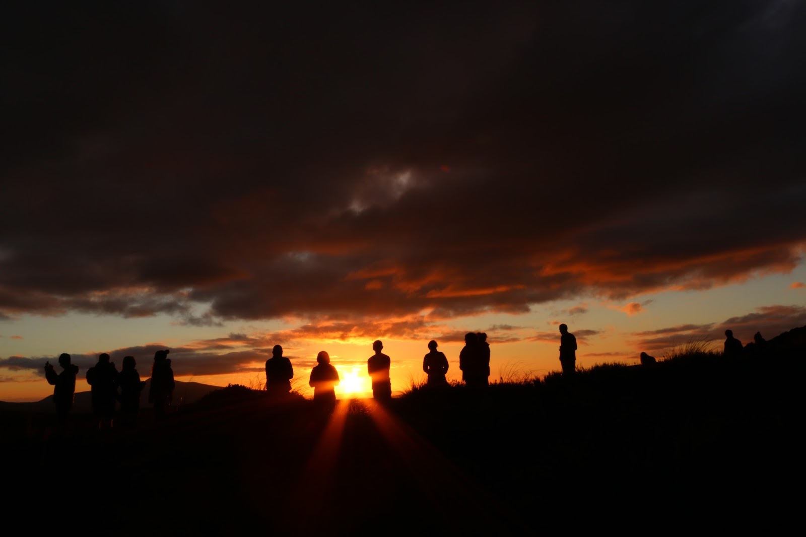
Sunset, Mangatepopo
The weather was perfect for night walking – clear, cool but not bitingly cold, and with a reasonable moon. We had head torches in our pockets mostly for when we were in and out of our packs changing up layers, relying solely on the moonlight for walking. We could see head torches ahead of us on the staircase, but we never caught up with them.

Near the crest of South Crater we were overtaken for the first time by a daywalker (so, sometime around 5:45am), who soon went back down past us, looking for his girlfriend. We were shocked that he had left her behind in the dark.

The light was starting to rise on us, and with our night-adjusted eyes, South Crater looked bathed in sunlight well before the sun was up. We made it to the edge of the crater just in time for sunrise and settled in with all our warm layers for breakfast at last. It was bitterly cold at this point, probably the hardest time of our morning, and we still hadn’t made it to the top.

Emerald Lakes
More people were starting to come up and through to overtake us at this point, and a group was already on their way back as we paused just before the crest of Red Crater, while a drone illegally flew overhead, ruining the otherwise peaceful morning atmosphere.

We finally started warming up as we headed down Red Crater to Emerald Lakes, and by the time we had taken more stops here, and gotten around the bottom lake to the track to Oturere Hut, the top of Red Crater was covered like an ants nest with people – a sight we regularly looked back onto for the rest of the day. We were thrilled to have beaten the crowds.

Once back off the Alpine Crossing, the track condition deteriorated again, and was a huge climb down before meandering along towards Oturere. Our fatigue started showing here, as everything took longer than expected.

Oturere Hut
It was cold when we arrived at Oturere, not long after most of the previous nights occupants had left. The windows were all open to air it out after a night of a full hut of wet people, and while it was sunny, the cold breeze made it a generally unpleasant place to be.

The first of the people we had left behind at Mangatepopo at 3am started arriving within an hour of us, and soon the weather warmed and I got sunburnt feet from wearing jandals and long johns. The people at Oturere were absolutely lovely, and we had a great night, but the hut itself is WELL too small for the number of bunks it has, with one small laundry rack, a table that can seat 6 at a squeeze and only four cookers to deal with 27 beds and space for 15 more in tents. It also only had one working tap – that hut was ripe for a norovirus outbreak. Thankfully it had a generous deck with several picnic tables and we hit good weather, so most people hung about outside.

Monday morning I woke shortly before sunrise, then missed the best colour of sunrise by being in the bathroom. It was another beautiful one, this time with lots of cloud to colour unlike Sundays clear blue sky. We had a lot of ground to cover (about 24km), so we didn’t dither in bed, but instead started prepping to get up and away towards Waihohonu in good time.

The track between Emerald Lakes and Waihohonu was my least favourite of the entire circuit. I simply found it all hard going and uninspiring. We arrived at Waihohonu fatigued and damp after the days first rain shower came through, and met people who had left before us already departing again after their morning tea break. We stayed for lunch instead.

Stormy Conditions
Waihohonu to Whakapapa is actually pretty good condition track overall. A couple of bits are a bit boggy / old, as if they are still on the upgrade list, but much has been laid with gravel and stairs. In good weather (but not too hot), it would be a rollicking walk with incredible views of Ruapehu, Tama, and Ngauruhoe. Instead, we could barely see anything for the day, which did make it hard to gauge how we were going.

About 1/3 of the way across a sudden storm passed through. The forecast had been for “passing showers, becoming heavy in the late afternoon”, but with 0cm accumulation of rain every 6 hours. We did not expect hail, gale force winds, and torrential rain that had us soaked through on our legs within seconds. Heads down, we kept moving.

The rain didn’t hang around for too long thankfully, and the wind cooled us off. But every time we thought maybe we could put our jackets away, the rain came back. After the second to-the-skin soaking, when the wind turned bitterly cold, we stopped (in the rain) to take off our jackets and add an extra layer – this was hypothermia weather if ever we saw it.

We opted not to go to Tama Lakes, as we were cold and tired and just wanted to get to the end. We rested at the top of Taranaki Falls in some rare warming sunshine before putting our coats back on to keep warm for the last push home across the tops to the village. The moment when we could see the chateau was amazing.

Hot showers at the lodge, cheese and crackers before dinner, an early night and hot pools at Tokaanu the next morning rounded out our adventure.

Wednesday, 6 January 2010

So much for 5 days...


Our plan for the summer break from Christmas to New Years this year had been ambitious. Too ambitious, the weather gods decided!


Original Plan

Day One - Holdsworth Road end to Jumbo Hut via Atiwhakatu Hut and Raingauge Spur

Day Two - Jumbo Hut to Mid Waiohine Hut via Mt Holdsworth Summit

Day Three - Mid Waiohine Hut to Maungahuka Hut via Aokaparangi Biv

Day Four - Maungahuka Hut to Totara Flats Hut via Neill Forks Hut, with possible detour to Tararua Ladder

Day Five - Totara Flats Hut to Waiohine Gorge Road End

So, it rained, or blew gale force winds the whole period between Christmas and the return to work...


New Plan

Head to Ohakune for a couple of nights and see about fitting in the Tongariro Crossing, plus a couple of day walks (hopefully beating the bad weather to that part of the country) and then head to the beach, hope the weather clears and go into the Tararuas later in the holiday break...

Well. We didnt beat the weather.

We set up our tents in Ohakune in hot, sticky and claggy weather mid afternoon, wandering off to the supermarket in shorts and t-shirt, almost hoping it would rain on us without our umbrella or raincoat. It didnt. After picking up the bits and pieces we needed for the next couple of days, we started looking into options for doing the Tongariro Crossing - debating the merits of taking our own car around and getting a one way shuttle, then heading to Tokaanu for the hot pools, or just getting the shuttle both ways.
Given that going to Tokaanu would quite possibly have had us back in Ohakune so late that we would have had to go to Waiouru for dinner (everything closes at about 8pm in summer), we decided to do a return shuttle. The company we wanted to book with said they werent planning on going the next day because the weather was going to be too bad, but to call them after 6.30 the next morning to reconfirm.
I admit, I went to bed sort-of hoping that when we rang at that ungodly hour they would say the weather was still going to be too bad, and I could go back to sleep for a while longer, but they didnt. Instead, we were told we had 30 minutes to get organised and be outside the campground for pickup. Cue rushed bolting down of half-sized bowls of porridge and quick filling of waterbottles and being thankful that we had made lunch the night before!
The weather was looking pretty nasty, and was on the edge of being bad enough that the shuttles wouldnt go, but we went on anyway, being dropped at the road end unable to see anything up the valley. It did not look much like it was going to be fun.
The weather stayed bad all the way up to Soda Springs, where most of the others in our shuttle were stopping to have the breakfast they had not had time to have before they left. Under my raincoat, I changed clothes at least once along here, swapping my warm thermaplus for a running top since it was quite muggy. I was really glad of this all the way up the devils staircase. I was also really glad to not be able to see the top as we were climbing up, as I really just wanted to stop and go back for most of the climb!
Once in south crater, the cloud clagged in even further. There had also been quite a bit of rain as there were some large puddles around. Interestingly, it was better to walk in the middle of them, where the ground was still solid with a layer of water on the top, than around the edges, where it had become mud. Once at the turn-off for the Tongariro Summit, we saw a brief couple of moments of sun, but Red Crater was still largely hidden, even when standing on the edge of it!
The drop down to the emerald lakes was longer than I remembered, and I was glad of the bad weather putting so many people off, so I didnt have to weave among slower walkers. When we got down there, we stopped for a museli bar each, and I changed back into my warmer thermaplus, as the wind was getting quite strong and cold on my now-soaked-to-skin body.
Beyond blue lake is the cairn valley, very cool and very odd. The zigzags down to Ketetahi Hut weren't as bad as I remember, although this could be because we couldn't see the hut, so there was no agonising "Oh my god, another zig zag." or thinking of dropping down the ridge direct to the hut. We had lunch on the deck in occassional sunshine, which was lovely and then missioned our way out the last of the track in time for a 4pm shuttle, as did all but one other couple from our morning shuttle.
I was very sore in the backs of my knees after the tramp, with an awful burning sensation. We discovered that I was badly windburnt when we had a bath at the campground. It certainly made for an interesting night in a little tramping tent, especially when I had to get up and go the toilet at 3am and had to crawl, crying, out of the tent!
It started raining heavily overnight, and we packed up the tent wet, quite early, keen to get to the beach house, real beds and the care of my Mum for my legs! Mark drove because the pain was so distracting. We stopped briefly at Te Apiti windfarm, and then again in Woodville for cheesecake and toilets, but other than that, it was pretty much straight through, arriving at the beach early enough for us to peg the tents flat to the ground in the gale force winds and sunshine and watch them take 30 minutes to dry!
So, we didnt even look at the Tararuas! By the time my legs had recouperated and I could walk properly again, it was time to go home and get ready to go back to work! (they are still peeling in places though!) In any case, the Tararuas had had nearly half a meter of rain over 6 days while we were away, along with low cloud and gale force winds. It really wouldnt have been a nice time to be in there. I'm still dissapointed at missing all those new huts - but now I'll just have to go later instead!
Photos to come (written at work, all the photos are still on the computer at home!)

Tuesday, 23 September 2008

Helicopter-tastic, Episode Two

Saturday 21 June 2008


Tongariro Crossing, Mangatepopo Road End, Tongariro National Park.

Team: Rene, Paul, Myself

As Mark was away in Europe, I was often away tramping for weekends to keep myself occupied. WT&MC does a Winter Solstice trip every year to the club lodge, where you daywalk on Saturday, party Saturday night and then mooch around a bit on Sunday before heading home. Plans are always fluid depending on who is around, what the people who are capable to lead feel like doing and what the weather is up to. This year we had fantastic clear, crisp skies. The schedule indicated Tama Lakes as the daywalk, with a mountain bike trip to a local loop.

Paul, Rene and I all agreed we didn’t really feel like doing the Tama Lakes walk again. I had done it in November 2007 and found it a bit tedious. Instead, with clear weather in winter we were keen to head over to the Tongariro Crossing to do a there-and-back to South Crater, picking up the mountain bikers on our way home in the afternoon.

The sun was bright and there was not a cloud in the sky as we parked the van at the Mangatepopo Road End. It was absolutely freezing, especially in the shade. As we meandered up the valley towards Soda Springs, every pool of water we found was frozen up to two cm thick, and further up the valley even the streams were frozen over in places. Large segments of the track also obviously never saw sunshine at that time of year!

Frozen in time A river flows through it

We passed very few people, except one really oddly dressed tourist in jeans and chucks, carrying a stereo in her shoulder bag… She must have had a really early start, because she was at Soda Springs the same time we were, about 10am, heading down the valley towards Mangatepopo Hut.


Morning Tea in the sun

Up the new devils staircase in the sun and cold, we got to the top and sat down to take a morning tea break, enjoying the views across to Mt Taranaki and the sunshine. A decision was made that I would wander into South Crater and try some photography, while the guys were going to try and circumnavigate the bowl of South Crater and pick me up on their way back.

All of a sudden there was a scream from slightly further along the track. We all looked at each other and looked across to the large asian woman who we had all noted walking towards us. We waited 10 seconds or so to see if she was going to get herself up, and when she continued screaming instead we all packed up our gear and headed over to find her moaning in pain, lying in a puddle with her ankle at a very odd angle.

In these conditions, with the cold and a strong breeze, the first concern we had was moving her out of that puddle because none of us had suitable dry clothing to change her into. So we grabbed her under the arms and around the knees and shunted her ever so slightly backwards. She spoke almost no English, so our examination was exceedingly cursory – “where does it hurt” was understood well enough as she pointed at her ankle (which was obviously damaged). “Are you warm enough” generated a response of her grabbing more clothes out of her bag (she was remarkably well prepared compared to many other tourists we had heard stories about).

There were no two ways about it. There was no way we could get her out ourselves. We were at the top of the Devils Staircase with a larger (about 95kg+) woman who spoke very little English and with only a very basic first aid kit. We couldn’t support her ankle enough for her to use it, and we didn’t have enough strength to carry her out, nor could we explain sufficiently assisting her out. So out came the cellphone and a desperate attempt at finding enough signal to make an emergency call.

Our lunch spot had coverage sufficient only to send texts and make emergency calls. Perfect. We pulled out the map and the GPS and got readings off both of them for where we were. Rene thought it a bit odd that I asked for the police when I rang 111, but then had a dawning realisation when I then asked for the northern region search & rescue coordinator. Wonderfully, the woman we got on the phone was an avid tramper and had been in our exact location less than three weeks earlier.

Once we had given them an update on what was happening, there was nothing to do but sit and wait. Unfortunately, none of us had brought a cooker or similar with us, so a hot brew was out of the question. It also wouldn’t have been fair on our injured party as we had been instructed that they were only to be given water. No painkillers, no food in case she needed urgent surgery or similar once in hospital.

After what seemed like an eternity (but was only really a couple of hours) and a couple of false alarms where the aircraft flying towards us was obviously on a tour, the chopper we wanted hovered into view right down at the road end, following the track up to find us, as we had expected they would. The closest landing spot was our morning tea seating area, slightly above us.


Rescue! All hands

During this time we had encountered several other tramping parties, some of whom had decided we obviously had things under control, some who completely ignored the situation, but we were so thankful for the small party of kiwis who gave up their attempt to get over the crossing in order to take a note back to the road end for our patients friend explaining the situation, and making a phone call to confirm our situation to SaR once they were back in cellphone range.

Finally someone else was taking over the situation, and we were all exceedingly glad. By this stage Rene, Paul and I were all wearing every single item of clothing we had brought along for the day and we were still feeling the cold. The cloud was also closing in on us, which had caused us substantial concern about visibility for getting the helicopter in if it had come in any further before it arrived.

After loading our patient into a stretcher and taking a quick photo of the “team”, we carried her over and up to the chopper and they were off to try and find her tramping companion – the one we had seen earlier in the day carrying a stereo and wearing jeans. As for us, we were off back down the track towards our van and its warmth. By the time we had made it down into the valley, the ledge we had been standing on when the helicopter arrived was no longer visible. By the time we were 20 minutes down the valley, even the head of the valley had disappeared into the cloud.


Load her up And away

Once back in the van, it was time to wait for the mountain biking boys and then we were back to the lodge in near-darkness to have hot showers, retell our story and rest up before dinner and the all-evening party that is solstice weekend.

Monday, 13 August 2007

Tongariro Crossing

April 21-22 2007.
Team: Emily, Nick, Kate, Amelia

This was almost a disaster of a trip. Adam was supposed to come and then couldnt, Emily, Kate and Nick were all supposed to car pool and then couldnt. In all honesty, I was amazed that this trip ever even happened at all. Anyway, into the car I eventually got, off on the road north out of Wellington on a Friday night at rush hour. 2 hours later I finally got to Levin, where I had the WORST McD's ever. It was a long drive and a dark night, but eventually I got to Whakapapa Village, where we were all meeting. Nick and Kate were already in their pits in the DoC Centre, Emily was still at the bar. By midnight we were all in bed, sleeping as best we could on small mats, on a cold wooden floor with no insulation (cant complain too much, the accomodation was free and the toilets were nice).

Then comes about 1.30am. The local volunteer fire brigade alarm goes off - RIGHT behind the shelter we were staying in. It woke up every single person staying in the village I would say at a guess, by the number of people out roaming the streets after that. Of course, everyones first concern was that it was the emergency evacuation alarm... At least, thats the first thing that ran through my mind...

Saturday morning dawned COLD and a little overcast, but a quick chat with a local shuttle driver informed us that things should clear during the day, which cheered us up no end. We took all three cars around to the other road end, had some breakfast while the shuttles came in to pick up people leaving their cars at that end, and then took my car back to the start of the track. Spending just enough time dawdling around, getting organised, meant that we were right near the back of the people starting the track when we finally got on it at just before 9am. We managed to time it perfectly - hitting just a nice quiet spot and avoiding most of the huge crowds that tend to ruin the track for many other people.


Nick and Kate powered off away down the track so that they would have time to climb Ngaruhoe and still make it out in time to drive home to Auckland that evening. Emily and I continued at a more leisurely pace, stopping every few minutes to take photos and bemoan our large, overnight packs, which were carrying more food than most others, and also sleeping bags, eating and cooking gear. We stopped near the toilets at Soda Springs for our first "meal" of the day - a good size snack to give us energy to really attack the hill ahead of us.

Once we were at the top of that hill, it was time to take a break, have some more food (it had now been well over an hour since we last ate), admire the view and take some photos. Then it was off across the crater to the next climb, passing the turnoff for Ngaruhoe (we decided we were carrying too much stuff for a summit attempt) and wombling onwards.

Once we got to the summit of the track, there was an option of a side-track to the summit of Tongariro, which we decided to take. Emily and I were both feeling the effects of carrying overnight gear and food, as well as being a long way above sea level (1700-odd metres feels like a lot when you usually live right near sea level). So we dumped our packs, each put something warm to wear on (the clouds were rolling in somewhat, making it misty and cold), grabbed our cameras and wandered off. The photo above is Emily from halfway to Tongariro, looking over blue lake.

Summiting was a neat feeling, as this was the highest I had ever been. We took the obligatory summit photos, spent a few minutes hanging around, played in the crusty snow that was there and wandered back to the main track. Once we got back to our packs, it was decided that 1.30 was a great time to finally have lunch (a real meal, not like those massive snacks we had been eating). We looked over to the main track and thought we saw Nick and Kate at the junction, also stopped to have some food, so we wandered over and (lo and behold) it was them indeed. Nick promptly dropped the crackers all over the ground, while Kate packed up the transiever and headed towards where Emily and I had just come from. Nick decided that one summit in a day was enough and came with Emily and I towards the hut.
It was a good walk to the hut, with a nice steep patch of scree to negotiate alongside the emerald lakes and red crater. We had some fun conversations, and eventually made it to Ketetahi hut, only about an hour before Kate joined us. We had hot drinks, chocolate, corn chips with salsa dip, and crackers and cheese for a couple of hours, playing tennis on the deck with others who were there. Eventually there was a great sunset, through the steam of the ketetahi springs, and we all decided it was time to eat. Emily and I had nachos, while Kate and Nick had a thai green curry and rice. Kate and Nick then headed off, and after another couple of hours of crazy games Emily and I went to bed.
My alarm went off at some rediculous hour the next morning (I think about 6.30). I stumbled about in my sleeping bag and managed to get outside without having to get out of the bag, and was rewarded with the most stunning dawn:
Soon enough it was time to tape yesterdays blisters, re-pack the pack (it still seemed to have as much stuff as the day before... and it turns out the raincoat and overtrou were completely unnecesary). Off down the track we headed, me storming off ahead for a few minutes at a time, then waiting so Emily could catch up. With her much shorter legs, Emily was a much slower tramper than me, and trying to walk at her pace caused a huge amount of pain in my knees going downhill.
All of a sudden, we were at the end...
And it was time to clamber into Emilys car and head back around to the track start and my car, get changed and head home. I stopped on the way for food in Ohakune, which was average, and then to take a look at the recently re-damaged Tangiwai memorial...

All in all it was a great trip and I am now looking forward to doing it again - but this time in Winter!