Showing posts with label Great Walk. Show all posts

Thursday, 25 February 2021

It's a long way to Kohaihai

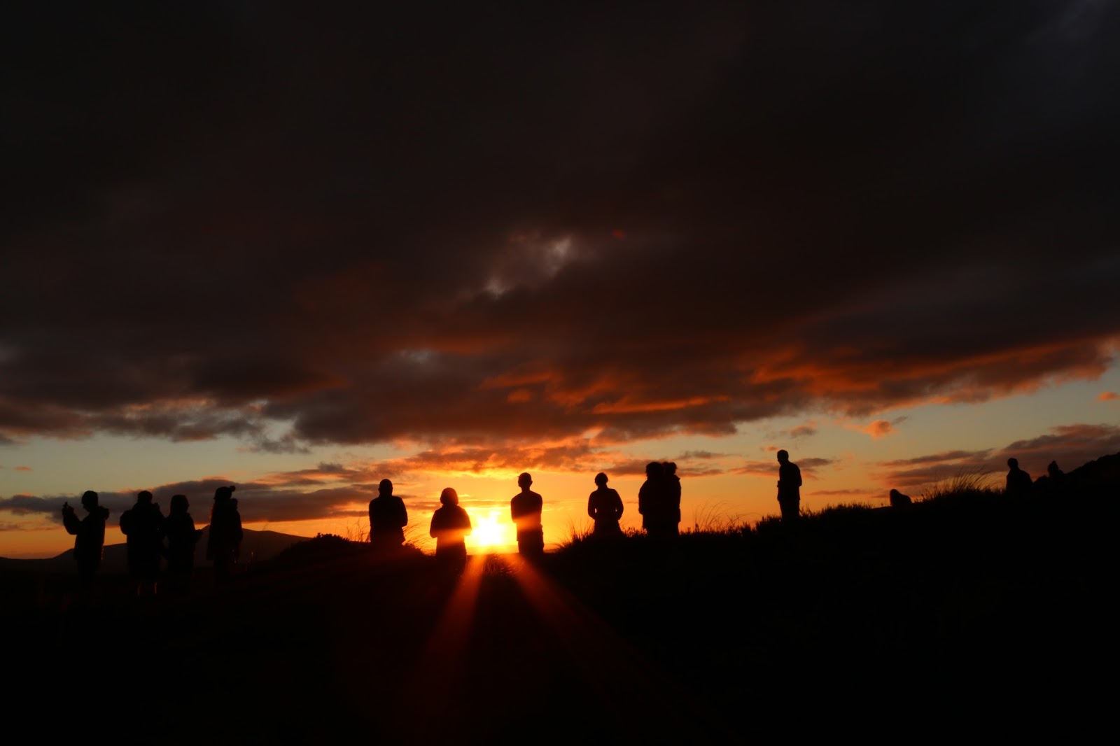
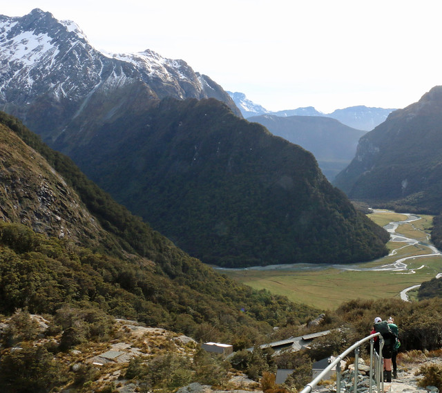
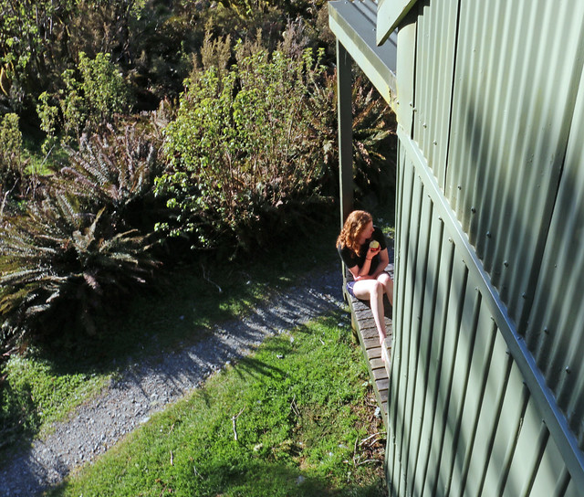
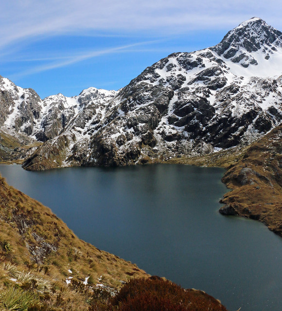
Early morning from James MacKay Hut, looking down to Heaphy Hut

Heaphy Track, Brown River Carpark to Kohaihai
Kahurangi National Park
02 - 05 February 2021

Team: Me, Marion, Ange, Jaana

 An adventure more than 12 months in the making, Marion had picked up the Heaphy Track brochure from the DoC Office in Oban as we walked towards the wharf, finishing the Rakiura Track in October 2019. It was never going to be on the agenda for 2020, because we wanted to do it early in the year, and were not going to be ready for February 2020.

With Marion and Ange locked in, we looked at all the travel options - shuttles, flights, car transfer - and decided on car transfer, since that offered the most flexibility and the least weather reliance. Plus, by the time there were three of us, even with the ferry, it was about the same cost. Doing this also meant we had a spare space in the car, so I put the call out among friends and Jaana jumped up to say she was interested.

It's a lot of travel to get to either end of this track - and the ends are both a long way from anywhere. We ended up staying the night before at Kaiteriteri, which was heavenly. A swim before dinner, burgers with a view of the beach, an evening stroll through the campground. Several of us genuinely discussed just staying put and pretending we'd walked the track it was so nice.

We knew that there weren't many places to stop on the walk up the hill to Perry Saddle Hut, so we aimed to hit the carpark at Brown River about lunchtime and eat before we started. As per the theme of the trip, being stationary outside meant two things: Sandflies and Weka.

This encouraged us to get going, so I put up all the sun shades in the car, popped the key in the lockbox, and we shouldered packs to head off. A very brief stop at Brown Hut for the toilet and the uphill started. And it just never stopped. It got hot really quickly, despite being fully in the shade, and we slowed down with our full packs. We stopped at Aorere Shelter for toilets, and the lookout at Flanagans Corner, and just kept moving towards the hut. We were about the last people in for the night.

Sunset was pretty, the guided group were doing very loud yoga in the main area that echoed through the whole hut while others tried to sleep, and I was awake before dawn. The toilets at Perry Saddle Hut were revolting, but best in the morning when the bugs were still asleep. 

We were up and out of the hut as everyone else started to stir as we knew we had a long way to go and my ankle was a bit iffy still from an injury in August. Our first fantastic moment was spotting a Takahe crossing the track as we stepped off the deck, so that was pretty magic.

We enjoyed the peace and coolness of the still dim bush section in our early morning, arriving at Gouland Downs Hut in time for morning tea hot already from the exposed section we'd already walked through. The whole rest of the day was largely like this, with small sections covered by trees, so it was super hot going for 24 long kilometers. While here, we met a couple and their three kids (all under 5!) who were walking the track over about 11 days - stopping all over the place and having multiple rest days.

Lunch at Saxon Hut saw most of us take our boots off for a rest, which felt amazing and allowed our feet to cool down a bit. The rest of the afternoon for me was a bit of a loss as my ankle became unbearably painful - every step hurt, and the pain spread through my whole body, leading me to a total mental collapse just under 1km from James MacKay Hut when Ange came back to offer to take my pack off me. I was entirely broken. And we were only just over half way there.

While Ange took my pack into the hut, I stumbled down the hill to the "Mountain Spa" to soak my feet. I spent a full 30 minutes with my feet in that ice-cold water and it was heavenly. Back at the hut, I took some painkillers and anti-inflammatories and lay down to rest while they kicked in, before enjoying dinner in the sun-drenched living space. In addition to the ankle, my overheated feet had developed deep blisters on my little toes, so I also tended to these as well as possible before hitting bed for an early night.

I realised the next morning that I probably wasn't eating enough. I had no salty snacks (I'd forgotten crackers or pretzels) and desperately needed them. But I also wasn't hungry - I was caught in that bind I sometimes have when tramping of not eating enough, then losing my appetite to go with it. I've decided that when I replace my current pack, the new one will have pockets I can reach while wearing it, so I can pack snacks in them.

From here our day was mostly down hill. My ankle had eased overnight and with a small amount of painkillers on board (plus a stretchy bandage) seemed to holding up. Marions knee decided it wanted to play up going down the hill instead, so we both took it super slow and gentle. We heard the daytime kiwi below James Mackay hut, but didn't see it.

This day was gorgeous. The bulk of the stretch down to Lewis was gentle gradient and all in the shade. After lunch at Lewis Hut (to be demolished as its falling over and being undermined by the river), we crossed the massive Heaphy River bridge and headed along the flat to Heaphy hut.

I want to go back and do that section in particular again. The flora is AMAZING. Stupendously enormous trees, really interesting rock formations, just wow. 

I arrived at Heaphy Hut limping a little and definitely uncomfortable, but in far less pain than the day before. Or so I thought, until I tried to climb the ladder into my bunk. I basically couldn't put my left foot on a rung of the ladder at all with any weight on it - if I did, the pain screamed all the way up to my knee like a red-hot poker. Bugger.

I limped down to the river for a swim, where the best way to avoid the sandflies was to go as far into the river as possible. Swimming in a tidal river is a strange sensation, as the water is constantly changing direction, vanishing and surging. But being fully submerged felt amazing.

Our whole bunkroom went to bed early to read, while some of the others went and had a driftwood bonfire on the beach for the evening. I had an absolute rubbish nights sleep and woke in the morning deep in a fug, wanting nothing more than to just stay put, unable to eat from exhaustion, absolutely convinced that the others were wishing I had never come and that I was a stupid burden on them that they didn't deserve.

Eventually I forced down breakfast and some painkillers and managed to get myself packed and ready to head off. I put my earbuds in and started listening to podcasts, because I knew I needed to not walk in my own silence for the day if I wanted to make it out in one piece mentally. It helped so much. Having my poles back from Marion was another great assistance in keeping moving, she had borrowed them the day before for her knee.

We never spotted clear indications of which beaches could be walked on if the tide was low enough (which is was), so we presumed none were suitable / had clear access back onto the track at the other end, and stuck to the track instead. It was amazing watching the coast go very suddenly from soft, light coloured sand, to massive boulder fields. The constant noise of the surf carried through the podcasts on my headphones. We enjoyed several reasonably new bridges, and had fun with the other non-bridged stream crossings.
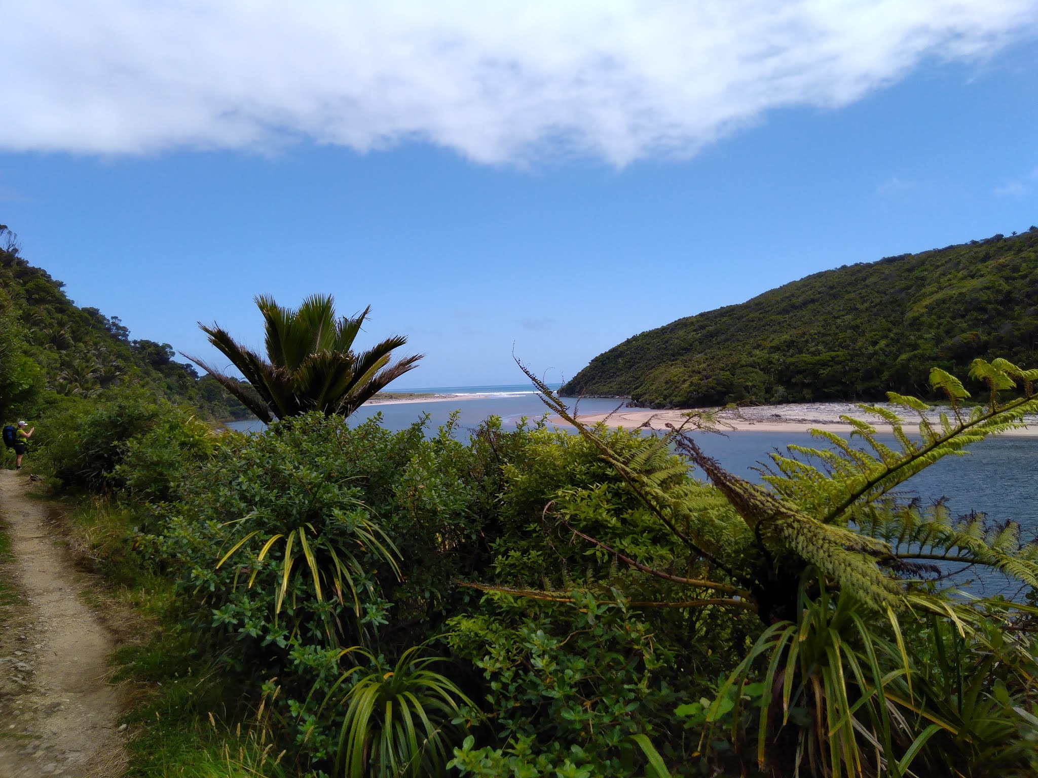
Eventually we reached a point where we could see what I was pretty certain was the Kohaihai Bluff. While the others stopped for a toilet break at Scotts Beach, I opted to just keep moving, knowing they would catch and overtake me pretty soon. Which they duly did.

Marion and I opted to take the detour to the lookout at the saddle - it was barely 2 minutes each way, and then it was all down hill. Just before we got there we met our first day walkers - a pair of ladies in lovely pretty dresses off to Scotts Beach for a picnic. We hoped they enjoyed the sandflies and the DoC worker mowing the lawn there with his weed whacker. The last section with the loop track and high water detour felt like it was forever, but Ange and Jaana appeared around here to cheer us in to the carpark. If they had caught us earlier, I might have given them my pack, but the signs all said we were super close (we were not that close).

Quick team photo at the sign, collect the key from the box, toilet break, dump gear in the car and we headed off, killing thousands of sandflies that got in with us as we went. We stopped for "lunch" or snacks (salty chips and coke for me, to wash down more painkillers) at Karamea, then at the Pool and Rec centre in Westport for showers (Oh they were amazing).

More food purchases at New World Westport, stops in Murchison and St Arnaud for snacks / toilets, Blenheim for dinner (and to buy me new jandals, I just could *not* manage sneakers), and we finally made it to the Top10 in Picton for the night as the receptionist was doing up late arrival packs.

Despite the exhaustion, I couldn't get to sleep. I was up for the bathroom several times, and then to hunt out safety pins to pop excruciating blisters, before popping a codeine at midnight and finally being out cold (for the all of 5.5 hours I was allowed before we had to be up for our 6:30am ferry check in).

Two weeks later, I've lost one toenail from the blister, my ankle is still an annoyance (and it feels like I may have plantar fasciitis in the other ankle), but oddly, I think I'd do this track again.

I'd got the other way though - the first day with the heavy packs would then be flat, the uphill to James MacKay is nicer than the uphill the other end was, and despite what the DoC altitude map suggests, there's actually heaps of uphill in the southbound direction. Also, I'd overnight at Saxon Hut, and make it a five night trip. That said, I'd also be keen to take Spike, and do 2-3 nights at Heaphy Hut with a daywalk to Lewis Shelter, or up to James MacKay for the night and back. While seeing the wild Takahe was AMAZING, I don't know if I *need* to do the whole track again...


Saturday, 10 February 2018

Exhaustion level: Epic


Tongairo Northern Circuit, Great Walk. Whakapapa Village to Whakapapa Village.
Party: Marion, Me
03 – 05 February 2018

Halfway up the Devils Staircase, under the light of the ¾ moon, at about 4:30am on Sunday morning, Marion commented to me that I was probably the only friend she had crazy enough to not only do, but suggest, such a trip. I think she meant it as a compliment.

Track, Whakapapa - Mangatepopo
After dropping off our town clothes and after-tramping food at the club lodge at Iwikau, we nabbed a carpark in the village, threw on rain gear and headed off on the “least maintained track in the National Park” (DoC Visitor Centre Rangers own words). With reasonable weather, we made it across to Mangatepopo Hut in good time. The track was definitely average, with some bits that would be awful in bad weather.

It was cold on the deck of the hut, catching the wind, with little to no sunshine, but it was lovely and warm inside with the gas fire going. We nabbed bunks, had some dinner, and re-packed as much as we could in preparation for Sunday mornings scheduled 3am alarm. After a gorgeous sunset, most of the hut started heading for bed, although the DoC Ranger on duty sat up being rowdy and drinking with a small group of others who had turned up with a significant quantity of beer and vodka.

Needless to say, Marion and I felt no guilt at all when we woke Mickey, who was sleeping on the kitchen floor (having given his room to his mother for the night), as we were heading out at 3:15am.

Sunset, Mangatepopo
The weather was perfect for night walking – clear, cool but not bitingly cold, and with a reasonable moon. We had head torches in our pockets mostly for when we were in and out of our packs changing up layers, relying solely on the moonlight for walking. We could see head torches ahead of us on the staircase, but we never caught up with them.

Near the crest of South Crater we were overtaken for the first time by a daywalker (so, sometime around 5:45am), who soon went back down past us, looking for his girlfriend. We were shocked that he had left her behind in the dark.

The light was starting to rise on us, and with our night-adjusted eyes, South Crater looked bathed in sunlight well before the sun was up. We made it to the edge of the crater just in time for sunrise and settled in with all our warm layers for breakfast at last. It was bitterly cold at this point, probably the hardest time of our morning, and we still hadn’t made it to the top.

Emerald Lakes
More people were starting to come up and through to overtake us at this point, and a group was already on their way back as we paused just before the crest of Red Crater, while a drone illegally flew overhead, ruining the otherwise peaceful morning atmosphere.

We finally started warming up as we headed down Red Crater to Emerald Lakes, and by the time we had taken more stops here, and gotten around the bottom lake to the track to Oturere Hut, the top of Red Crater was covered like an ants nest with people – a sight we regularly looked back onto for the rest of the day. We were thrilled to have beaten the crowds.

Once back off the Alpine Crossing, the track condition deteriorated again, and was a huge climb down before meandering along towards Oturere. Our fatigue started showing here, as everything took longer than expected.

Oturere Hut
It was cold when we arrived at Oturere, not long after most of the previous nights occupants had left. The windows were all open to air it out after a night of a full hut of wet people, and while it was sunny, the cold breeze made it a generally unpleasant place to be.

The first of the people we had left behind at Mangatepopo at 3am started arriving within an hour of us, and soon the weather warmed and I got sunburnt feet from wearing jandals and long johns. The people at Oturere were absolutely lovely, and we had a great night, but the hut itself is WELL too small for the number of bunks it has, with one small laundry rack, a table that can seat 6 at a squeeze and only four cookers to deal with 27 beds and space for 15 more in tents. It also only had one working tap – that hut was ripe for a norovirus outbreak. Thankfully it had a generous deck with several picnic tables and we hit good weather, so most people hung about outside.

Monday morning I woke shortly before sunrise, then missed the best colour of sunrise by being in the bathroom. It was another beautiful one, this time with lots of cloud to colour unlike Sundays clear blue sky. We had a lot of ground to cover (about 24km), so we didn’t dither in bed, but instead started prepping to get up and away towards Waihohonu in good time.

The track between Emerald Lakes and Waihohonu was my least favourite of the entire circuit. I simply found it all hard going and uninspiring. We arrived at Waihohonu fatigued and damp after the days first rain shower came through, and met people who had left before us already departing again after their morning tea break. We stayed for lunch instead.

Stormy Conditions
Waihohonu to Whakapapa is actually pretty good condition track overall. A couple of bits are a bit boggy / old, as if they are still on the upgrade list, but much has been laid with gravel and stairs. In good weather (but not too hot), it would be a rollicking walk with incredible views of Ruapehu, Tama, and Ngauruhoe. Instead, we could barely see anything for the day, which did make it hard to gauge how we were going.

About 1/3 of the way across a sudden storm passed through. The forecast had been for “passing showers, becoming heavy in the late afternoon”, but with 0cm accumulation of rain every 6 hours. We did not expect hail, gale force winds, and torrential rain that had us soaked through on our legs within seconds. Heads down, we kept moving.

The rain didn’t hang around for too long thankfully, and the wind cooled us off. But every time we thought maybe we could put our jackets away, the rain came back. After the second to-the-skin soaking, when the wind turned bitterly cold, we stopped (in the rain) to take off our jackets and add an extra layer – this was hypothermia weather if ever we saw it.

We opted not to go to Tama Lakes, as we were cold and tired and just wanted to get to the end. We rested at the top of Taranaki Falls in some rare warming sunshine before putting our coats back on to keep warm for the last push home across the tops to the village. The moment when we could see the chateau was amazing.

Hot showers at the lodge, cheese and crackers before dinner, an early night and hot pools at Tokaanu the next morning rounded out our adventure.

Wednesday, 17 January 2018

Milford Track - Stats & Maps

Tracking for this trip is WAY off, as I discovered once home that my iPhone likes to take aimless wanders into the local area when tracking on Map My Walk (for example, my 3.5km walk from daycare to work is apparently 4.6km on iPhone MMW, joy).
But, here's what I have, because this is now what I do.


Day ONE - Overall a good pace, we paused a lot to admire birds and the river near Glade Lodge, which slowed us down in that km, but given we only had a few km to walk and full packs, we mostly just kept moving.
Fitbit: 20,417 steps
MapMyWalk: 5.53km, 63m gain, 8,924 steps while walking, 4,322kJ
DoC: 5km (plus wetland walk)


Day TWO - the 4th km was our biggest gain (160m), but the last 2.5km included nearly 300m gain between them, and between that and the heat, we slowed down a chunk - our only slower km was the one where we put our packs down to whip into Pomplona Lodge to check if the wallet we found belonged there, and the tracker was left on in my pack. A constant, steady uphill with little to no respite. Interesting that MMW suggested more steps than I actually took - I've never had that happen before.
Fitbit: 32,496 steps
MapMyWalk: 20.55km, 763m gain, 37,531 steps while walking, 19,430kJ
DoC: 16.5km (plus two short side trails to waterfalls, probably 1km return each max)


Day THREE - I am enormously sad at just how much I can't trust the tracking on this day. According to MMW, we climbed nearly 1100m, including several stints of 200+m vertical in a km, when I know we were mostly downhill or along a ridge. The tracking looks like my 4yo tried to follow the line.
Fitbit: 37,628 steps
MapMyWalk: 24.32km, 1,083m gain, 47,312 steps while walking, 25,221kJ
DoC: 14km (plus Southerland Falls - about 1.5km each way)


Day FOUR - A steady day. A few slow kms, and a couple of spots where the iPhone just really could not get the tracking right, but it wasn't as far our as the day across the tops. At least the general gist of the tracks are right.
Fitbit: 37,377 steps
MapMyWalk: 20.68km, 329m gain, 35,333 steps while walking, 17,682kJ
DoC: 18km (no side tracks)
Example of one of the loops on the tracker

Wednesday, 10 January 2018

Hidden Scenery

Milford Track, Great Walk. Lake Te Anau to Milford Sound
Party: Mark, Me
19 – 22 December 2017


Getting to the Milford Track is a feat of organisational skill, even doing so as a domestic visitor. We had to know what dates we wanted so that when bookings opened, we were only trying for specific dates – and then we had to get through the overloaded bookings system, which we barely managed. Add in sorting getting physically TO and from the track, and well, it took a bit of planning!

After leaving Spike in Christchurch with his grandparents and cousins, we jumped on our quick flight to Queenstown, where it was gloriously sunny. Our bus to Te Anau (TrackNet) picked us up at the commuter bus stop immediately outside arrivals about 2 minutes later than scheduled, and dropped us to our accommodation in Te Anau.

The next morning, after checking out and leaving a bag at reception for our return, we hefted our packs and wandered along the lakefront to the DoC visitor centre to pick up our passes for the track. With a couple of hours free time, we then left our packs behind and walked back into town for a last café break before grabbing our bus.

The wind at Te Anau downs was fierce and freezing, so everyone bundled up into their jackets while waiting for the launch to arrive for our pickup. The sun came back out as we cruised up the lake, enjoying the views of the mountains and the Southern Rata, but jackets stayed on as it didn’t really warm up as we hit the start of the track.

The wander in to Clinton hut was largely smooth sailing. We stopped outside Glade Lodge to remove our jackets, and were the last independent walkers from our boat across the famous swing bridge over the Clinton river. It wasn’t long before we started spotting the robins that became synonymous with our trip. The bush was lush and thick, and we got snippets of view as we walked. Arriving at the hut, we found it only 2/3 full, both of us nabbing bottom bunks in one of the two bunkrooms. We settled in to chill out for the afternoon, reading or doing the jigsaw puzzle laid out in the dining room. It was a bit of a late night, given it didn’t get dark till after lights out and we hadn’t walked far – everyone had loads of energy.
The Praire

Day 2 dawned fine and clear. We ambled off about mid group, stopping regularly (at first) to admire the robins we were seeing along the track. It seemed not long before we reached the lunch shelter used by the guided walkers, where we later discovered we should have topped up our water. It was already getting pretty warm, so we enjoyed a break in the shade before heading off, planning to lunch ourselves at Prairie Shelter.

Prairie Shelter was a roof with no sides. It reflected the heat back in, did nothing to deter the sandflies, and would have been a miserable place to stop in bad weather. While it had a toilet, it had no water supply. It also had a local population of weka, which made the break here a bit more entertaining.

Along the way, at one of the side tracks, we had picked up a wallet accidentally dropped out of a pack. We made an effort to stop at the guided walkers lodge at Pomplona to ensure it wasn’t one of theirs from a previous day (we were confident the current days walkers were all somewhere behind us), before discovering just shy of Mintaro hut that the wallet belonged to a member of a party on our own walking day – good thing too, since it had drivers licences and car keys in it!

A half moments personal reflection was had as we crossed the creek bed immediately past the Guided Walkers Pomplona Lodge – likely the place where the young couple got into trouble a couple of winters ago – to contemplate the crossing of that water course in high flows without a bridge. Crossing it when there was no flow was challenging enough.

Eventually, after being slightly broken by the heat of the day and having run out of water, we made it to Mintaro Hut, where we grabbed a couple of mattresses effectively on the floor and chilled out awaiting a time suitable for cooking dinner, opting not to join several other parties in a mission to the top of the hill to see the views before the weather closed in.

The forecast rain arrived at about 4am, and was soon a steady drizzle. Such an incredible change from the heat of the day before. Suddenly there were thousands of waterfalls visible from the deck of the hut, and we were going up into the clouds and through to the other side in it.

The climb up to Mackinnon Pass was actually almost my favourite part of the trip, despite the weather. The track was well graded, the zig zags enabled good altitude gains while not being too steep, and despite the clouds we got glimpses of amazing views. Cresting out at the top we found the memorial and some tarns, with a bitingly cold wind that had us briefly confer about whether we should stop and put on additional clothing (we opted not to). Mt Balloon and the 12 second drop both kept teasingly peeking out of the cloud before vanishing again, and we spotted a very cold looking weka just as we arrived at the shelter.

Walking into the shelter was like walking into a steam room. Everyone was wet through and sweaty, plus people were (sensibly) taking advantage of the provided gas and water to have hot drinks before heading off again. The toilet with a view had no view to speak of, and one of the girls in another party was struggling with hypothermia (which her party had well under control, utilising group members spare gear and refilling a water bladder with warm water).

Down the hill was a long, slow, cumbersome slog. The track was clear, but not well-formed. There were a lot of unbalanced rocks and huge steps. It had some positives though – Roaring Burn Creek was amazing in the rain, and Andersons Cascade is a massively under-advertised part of the day, especially if it’s been raining.

We finally stopped for lunch at Andersons Cascade shelter, most of the way down the hill. We were eaten alive by sandflies while there, so didn’t stay for long, opting to push on towards Quintin Lodge, where there was another shelter (with a flush toilet and a water boiler). We had decided on our way down that we wouldn’t go out the side track to Sutherland Falls as we were both so tired, but after 20 minutes rest at Quintin, were persuaded by others that we should. We made it to the second swing bridge before deciding we were rather done-in and needed to be aiming for our own hut again.
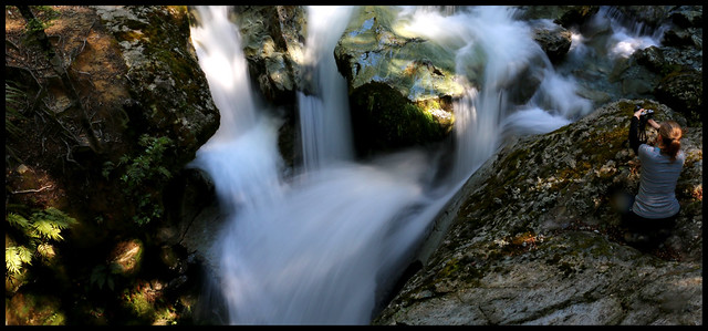
Not our pack, thank goodness!
Dumpling Hut was a sight for sore feet when we finally got there, although we were far from the last in for the evening. The bunkrooms stank from people hanging their sweaty damp clothes on the bunk ends (to avoid kea predation), despite there being drying racks in the living room. Most people retired early for the night, disbelieving the wardens suggestion on walking times, after all taking significantly longer to get down from the pass than suggested by the previous warden.

Mark and I were the last ones out the next morning, departing as the first guided walkers appeared on the deck in search of toilets. I had massive tendonitis lumps on my Achilles, and so was unable to walk in my boots, instead needing to strap my feet and borrow Mark’s Teva sandals.

Giants Gate Falls
The walk out was odd – I was actively trying to keep my feet dry for starters, and had to be concerned about rocks because kicking one accidentally would have been painful. We ran into Akiko again (a guide for the private walkers, who we had jump-frogged with the day before) a couple of times and she was full of good advice for dealing with the walk out in sandals.

The various waterfalls on the last day of the Milford are lovely, and the track was largely under cover of trees, so not too hot. We made reasonable time, but the last mile seemed interminable. Arriving at Sandfly Point shelter about 5 minutes before the recommended 15-minutes-before-departure of our boat was a relief.

The boat trip back over was incredibly bumpy, as the rivers were up and the tide was moving in, along with the afternoon sea breeze. When we loaded, we had all considered that perhaps opening the blinds would be good to let the breeze in. By the time we were half way back, we were super glad we hadn’t as the spray was huge.

Grabbing a seat in the air conditioned wharf building while we waited for our bus home, Mark whipped up to the café to get ice creams, which were absolute bliss. Thankfully there were only about 6 of us on the bus, so we could put our feet up in preparation for limping off at our accommodation in Te Anau.

Wednesday, 16 December 2015

Routeburn: The physical work

I used Map My Walk on my phone to track our route - speed and altitude - for our Routeburn Tramp, and it was quite interesting (and INSANE) to contemplate, now that its all said and done.

 Day One. Not at all sure what was recorded for that first hour, because I'm pretty sure it wasn't all down hill (and dramatically so), especially since the breakdown suggests we started at 580m, not the 1500-odd that the elevation indicator shows! The map is fairly close to accurate though for the line.
You can clearly see where we started climbing - bang on the 9km mark. There were a LOT of stops on the way up the hill, and I had a rule that apart from lunch, I didn't stop the tracker during the day. Every km has some climb, with the last 2.7km involving 330m uphill (Routeburn Flats to Routeburn Falls Huts).
Fitbit: 24,398 steps over day
MapMyWalk: 10.72km, 14,577 steps while walking, 16,000kJ

 Day Two. Started reasonably high and got higher. You can see we climbed quite gradually up to the saddle, then it was a chunk of drop on to the Hollyford Face, before a gradual climbing sidle to the top. Clearly Laurie and I made good pace dropping down to Lake Mackenzie. Average pace much slower, and that first 3km was SO slow. Yikes. That will have been the 400m climb, plus the views, snow and heat! The last 2km was almost entirely downhill, with only a 3m gain from the lowest point at the very end. All other km breakdowns had a bigger climb.
Fitbit: 30,211 steps over day
MapMyWalk:  10.93km, 14,870 steps while walking, 21,824kJ

Day Three. Our fastest day on average, which is awesome, considering how exhausted we all were. Also just the longest. The gradual climb away from the hut is clear, and then its obviously a long sidle around. The descent to Lake Howden looks more obvious here than it felt at the time. The slower sections involved a bit more climbing on rough terrain (which Claires sore feet found really hard) and then the 5-6km distance involved Earland Falls, which we negotiated very slowly (large, wet rocks, with a nasty fall), and stopped for food.
Somehow, our climb up to the Key Summit turnoff (199m over about 1km) only took 20 minutes, and every single km involved SOME uphill from its lowest point (the least uphill was the last km, with 4m up).
Fitbit: 31,943 steps over day
MapMyWalk:  12.91km, 17,555 steps while walking, 18,723kJ

Tuesday, 15 December 2015

Sunshine on Harris Saddle

29 November - 1 December 2015
Routeburn Track, Mt Aspiring / Fiordland National Parks
Team: Laurie, Ange, Claire, Marion, Me

Friday was spent in a haze of packing and worrying. Reports in from Queenstown were not good - a severe storm had just gone through and the Glenorchy Road was closed due to tree fall. Thankfully, by the time we got to the airport on Saturday afternoon, the roads had been cleared and power and been restored to the district.

Our adventure began at Queenstown airport, where Claires pack lost a strap when she tried to pick it up to carry it to the taxi stand. Oh dear. A pack with only one shoulder strap is no use for a 3-day, 32km tramp. Grabbing a taxi the 1/2km to our accommodation (because our bags were huge and it was trying to rain on us), we started googling for pack hire, trying to find one local at Remarkables Park. No such luck. We sent Claire off on the bus to Queenstown to pick up a hire pack in town, while we aimlessly wandered the supermarket for ages getting our tramping food and something for dinner.

Sunday morning dawned incredibly fair, if a little nippy. Up stupid early to get everyone through a last shower before we hit the track, we were all just nicely ready when our shuttle arrived to collect us. The amount of treefall on the side of the road was incredible. It was amazing what the roading staff had managed to clean up since the storm.

We were among the first on to the track that morning, our five, two others who shared our van, and a group of guided walkers all heading off at about the same time. We overtook each other with regularity past the first gorgeous waterfall, and all the way to the riverside where we stopped for morning tea and to soak in the atmosphere of exactly where we were, and what stunning weather we had (just in case it didn't last - Fiordland weather is fickle!).

Cascading A river runs through it

Cruising on up valley, we got to Routeburn Flats hut at a good time for lunch. Yes, it had taken longer than the DOC suggested time to get there, but while we had fine weather we didn't care. Chilling out in the sunshine at a picnic table on the grass in front of the hut was blissful. The hut is clearly designed with daywalkers in mind, having a HUGE covered space with benches, sinks, tables and seats.

The rest of our days walking was uphill. All of it. So in went my earbuds and off I went. We agreed before we headed off that we would all climb at our own pace, taking long stops in a couple of specific locations, with the person at the front regularly waiting for sight of the person at the back, and each person stopping when they wanted to, for however long they wanted to (avoiding the caterpillar effect of the front stopping and then moving on as soon as the back catches up, leaving the back feeling like they dont get a break).

Find the trampers

The climb was a long, plodding slog. But we made good time - I arrived first in just on 1.5 hours, and the others dribbled in one every 5 minutes after that. I had planned to walk back down the track and find the back marker, since I was feeling good, but by the time I had greeted each person and celebrated with them that we had made it, the next person had arrived.
Snagging ourselves some bunks, we also grabbed a prime position on the deck, where we had a view out to the peaks on the opposite side of the valley, and chilled out for a while. It was still early afternoon, but Routeburn Falls Hut was already largely in shade. Taking turns, we went for wanders up to the falls proper, and down to the prominent rock below the hut (which is so popular it really needs a track built to it rather than the scramble over slippery boulders that you take at the moment).

Dinner was endured, the hut talk from the ranger was hilarious, and we all stayed up late enough for the lights to turn on. The early loss of sunshine meant the bunkroom was quite cold - the dining room was only warm because the ranger had lit the coal range around 5pm.

Waking at 6am Monday for a toilet break, I discovered that some keen beans were already up, packed and on their way out for the day. The beginning of the morning was beautiful and I contemplated just staying up, but opted to go back to bed for a bit more rest as I knew we had another chunky climb and big descent ahead of us.

Routeburn Falls Hut

Breakfast, pack and a little bit of housekeeping later and we were on our way. Two steps off the deck and the climbing that would be the bulk of our day started. We dawdled our way up to the top of the falls, enjoying our last views over the Routeburn Valley. Then we turned into the upper valley below Harris Saddle. Wow. The valley opening ahead of us was immense. And incredible. The track vanished into the distance where we could see tiny people walking ahead of us. 

Rocking out Lake Harris

We took a LOT of photo stops on the climb up to Harris Saddle, including to play with some snow and to watch an Australian family climb a huge rock to get a great photo. We again followed our caterpillar approach, each walking at their own pace, stopping frequently to make sure everyone was ok. We briefly debated stopping for something to eat on the promontory overlooking Lake Harris, but opted to continue on the 500m to the shelter at the saddle and have an early lunch (so we could claim to bag it by stopping in and eating there). We somewhat regretted this decision, as the promontory had been sheltered from what was actually quite a cool breeze apparent at Harris Saddle Shelter.

Harris Saddle

Lunch at Harris Saddle was rediculously early - not long after 11am. But we figured from the map that it would be our last place to stop and stretch out for a good couple of hours at the pace we were all going. The trip along the Hollyford face is a bit of a blur for me. The combination of heat, exertion, pack weight on shoulders and sunhat / sunglasses pressing on the side of my head was not doing wonders for my brain. This was exacerbated by running out of water before Ocean Peak Corner, leaving me with a near migraine. The views through this part of the day became a bit monotonous, compared with what we had been experiencing, since we were simply walking above the Hollyford Valley for several kms. Some parts of the track are quite tremendously exposed through here, which left some members of our party struggling.

Laurie and I wound up pushing ahead to try and beat my migraine to the hut, leaving the other three behind as a group to make their way at their own pace. Just before we started off, having left a message with the Australians to pass on to Ange, Marion and Claire (who we were confident weren't far behind us), we saw Ange bounding up the track with no pack on. "Oh fuck" went the murmur through the six of us. Thankfully, Ange was just coming to tell us they were fine, just slow, struggling a little with the exposure and Claire having a sore foot and were more than happy to just see us at the hut. I was loathe to break the group up to the extent we were going to. But if I slowed myself down to Claire's pace with her sore foot, I would have been blind from the headache before I reached the hut.

We tried to cheer them (and ourselves) up by telling them the top should be "just around the corner". This was a lesson in how big a distance "just around the corner" is, in such a landscape. Turning the corner at that point, where we thought we had done the last of the uphill / sidle and should be starting to drop again was the only point of the trip where I really struggled - more uphill. We were sure the ranger the night before, and the track profile in the brochure had said it was "basically all downhill" from Harris Saddle to Mackenzie Hut. What a load of bollocks. It was a bumpy sidle that seemed a lot more uphill than down and ended with a vicious wee climb.

Down there

A seat in the shade with lots of water, no pack and no sunhat was such a blessing once we finally got to Mackenzie Hut, first spotted as a tiny dot ALL THE WAY DOWN THERE. Laurie and I collapsed on the front deck of the hut at about 3:15, just over 7 hours after we left Routeburn Falls (although we did spend nearly an hour at lunch). We dithered for a bit about bunk spaces, eventually signed ourselves in, changed out of our sweaty clothes and into lightweight alternatives (it was still 22C at the hut at 6pm, despite being at nearly 900m AMSL).and settled in to wait for the others, hoping they weren't too far behind.

Our relaxed state started turning to nerves as our self-imposed "will go looking for them" (to make sure nothing had happened) time started to draw closer. We asked people as they ambled in if they had seen them, and most indicated their last sighting had been somewhere up on the switchbacks above Lake Mackenzie. Finally, the ranger (who we had seen way up on the Hollyford face) came through and said he had seen them only a couple of minutes prior, taking the turnoff for the high water track. Finally, over 2 hours after Laurie and I arrived, and nearly 4.5 hours since we had last seen them, they stumbled in. Claire promptly burst into tears of relief at having made it - her description of how she was feeling sounded a bit like plantar fasciitis to me, far from ideal when tramping.

Chilling Sun Strike

Another dinner was endured (freeze-dry is not really my ideal food, but with 5kg of camera gear, I was weight saving where ever else I could), we all had a quick wade into the (very cold) lake and wandered around in shorts, singlet and jandals till it was time for the hut talk. Which we had on the deck in the sunshine. Bliss. Until the sun suddenly vanished and the temperature dropped about 10C in 2-3 minutes. I was stuck in the middle of the group, unable to get out surreptitiously, still in my lightweight warm-weather clothes. Not ideal!

Bedtime followed almost immediately the hut talk finished (the ranger was certifiable, and hilarious), with a plan to definitely be off early in the morning to allow extra time for Claires foot to slow proceedings. Allowing ourselves 6 hours to complete track that was indicated to take 4-4.5 should be plenty, right?

Amazingly, Tuesday morning dawned brilliantly fair again. What a run of weather we had hit! The forecast was for rain “mid afternoon”, which suggested we may just miss it with our 2pm pickup. The track from Mackenzie hut ambles along with a few climbs for a while, then starts to sidle past a couple of gorgeous waterfalls. We left Laurie at the first to take photos, agreeing to wait for her at the second if she didn’t catch us before then. She caught up to us as we arrived at the massive Earland falls, which were beyond incredible. Thankfully the flood track wasn’t required, and so we could get an excellent view, walking across the bottom of the falls.
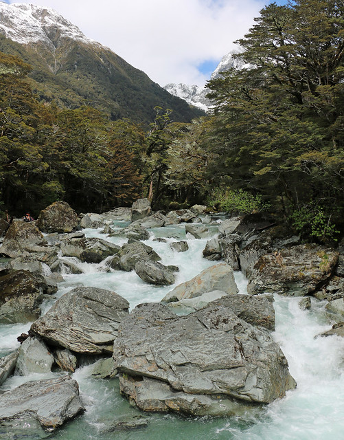
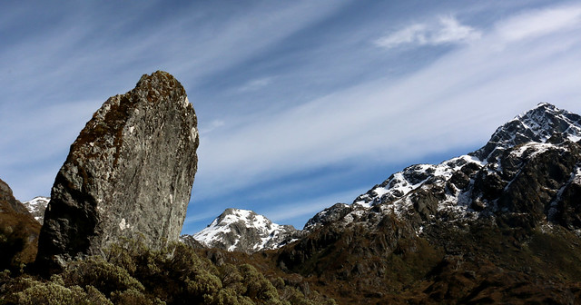
Tumbling down Earland Falls

Beyond here it was mostly downhill to the hut. I needed to pee and was losing sensation in one arm for some reason, so opted to push ahead of the group - no-one needed to put up with the grump I was developing - through to Howden Hut. Although I worried because I hadn’t seen the girls for quite a while by the time I got to the hut, they were only 10 minutes behind me. Sadly, we had taken almost a full 4.5 hours to do the “3 hour” walk from Mackenzie to Howden. The suggestion was 1-1.5 hours from here to the road end, and we had exactly 1.5 hours before pick-up.

Lunch was a hurried affair, watching the new batch of guided walkers arrive to be greeted with chocolate biscuits, hot tea and coffee and raro on the few picnic tables outside the hut, leaving us standing along the front of the deck. Laurie checked herself in for her night at Howden, grabbing just her camera kit, water and jacket and hefted Claires pack onto her back instead, to help Claire get up the hill in better time. Which worked a treat, those of us who left 5 minutes after her didn’t catch her on the slog up to the Key Summit turnoff.

Here we said goodbye to Laurie, who was continuing on to do the Caples track without us. Marion and I stretched out our legs and whipped down the hill as fast as we could to ensure we made it to the carpark before the “15 minutes or so” grace from the shuttle ran out, arriving at about 1:50 (which means, even at our good pace, it still took the full suggested 45 minutes down the hill). Dumping packs and grabbing a drink, Marion headed back to see if she could help the others, who walked out at 2:01 under their own steam, totally stoked (as well they deserved to be!). 


Back to Queenstown in the shuttle, window wide open almost all the way because it was still really warm. We grabbed dinner from the supermarket across the road from our accommodation, and then most of us headed for a walk to the pools (about 2km) for a shower and then swim, absolute bliss after three long days walking!