Showing posts with label Daywalk. Show all posts

Sunday, 31 October 2021

Lakes and Falls

Tama Lakes and Taranaki Falls
Whakapapa Village, Tongariro National Park

Saturday 23 October 2021

Who: WTMC Families - 6 adults, 5 kids

Finally, FINALLY, Mark got to go all the way to Tama Lakes. He's made a string of attempts over the years, but always ended up having the trip canned due to bad weather / lack of interest from others in the group.

We planned the entire weekend around the hope of making it, selling this to the Families Group as a tramping weekend at the lodge rather than a skiing one (which was a good call - the very upper mountain was open, but that was it), and I forced Mark to not bring his skis, especially since the forecast was for one good day.

We took the upper track to Taranaki Falls, where we waited a while for two members of our party to catch up after they had had to race back to the lodge to get a forgotten jacket (this is not an area where you can shrug that mistake off with a "she'll be right"). Not long after that, both LJ and I started having issues and lost our enthusiasm to continue on to the lakes.

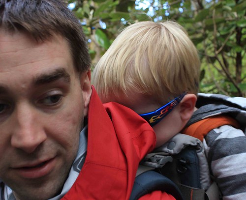
We kept going until we found a decent downhill leg, where we stopped for lunch. One of the other parents pulled out her phone and advised us we were under 1.5km (about 25 minutes) from the lower lake, which was enough to keep both a tired LJ, and her exhausted 4.5 year old going. I wasn't surprised that LJ was tired, he'd woken at about 5:15am and so he and I had gone for a 3km walk to Meads Wall for sunrise.

Lower Tama lake was brutally cold. The wind was extreme and completely freezing. Everyone put on additional layers for our stop. Four of the adults continued on to Upper Tama, while the other two of us wrangled all the kids into starting the walk back after a bit of a break. The Upper Tama parents came into sight behind us just beyond our lunch spot, and caught the front of our group about 15 minutes shy of Taranaki Falls.

We clambered down the steps to the waterfall and had another extended break, where the kids clambered around the back of the falls and the edge of the pool at the bottom, before chilling out with more food.

From here, we took ourselves along the lower track back to the village, which was a brilliant idea as it was largely in shade and next to a river for a large portion of the walk. All of a sudden it had gotten exceptionally hot. The last chunk of the walk back to the village in the sunshine was sweltering.

Back to the car and up to the lodge for afternoon tea and a rest.


Sunrise at the top of the Bruce Rd

Tuesday, 9 June 2020

Race The Dark

Paekakariki Escarpment Track, Paekakariki to Pukerua Bay
14 February 2020
Party: Mark, Me

At late notice, my parents offered to take Spike for a weekend to give Mark and I some time to chill out.
Late afternoon sunshine through the trees
So while they collected him from after school care, we took the train to Porirua together to collect our car, before joining Friday night rush hour traffic to Pukerua Bay, where we parked again to jump on another train to Paekakariki.

The wait at the Beach Road Deli for pizza was about half an hour, but we decided it was worth it, and grabbed a seat in the shade outside to wait, where we enjoyed watching traffic and trains go past.Sheep on a bridge

About 7pm, we finished dinner and were finally ready to start walking. It was gloriously warm, and we were walking in to the sunshine. The best thing about walking at this time of day was that we saw literally no one else the whole time. It was just us, a chance to chat and be together, and a small flock of sheep who kept us entertained.

The views were beautiful, and we got most of the way south towards our car before it got dark enough that we needed to get out our head torches. The experience of Sheep on the edgewalking in the dark with just us, on a track above the road, was different and fun for sure. That said, it was nice to get to the more solid footpath alongside the train track coming in to the old Muri station, and to have some streetlights.

We were just about clear of the railway tracks at the south end of Muri Station, when a freight train came barrelling up the hill and past us. HOLY WOW was it loud, that close to a pair of engines hauling a lot of freight up that large hill. And there were houses literally 10m away from the track at that location.

Arriving back at the car at 10pm was a great feeling. We stopped at McDonalds Jville on our way home for ice creams to enjoy when we got home. This was an amazing adventure, and I’m so glad to have a husband who is as keen on silly adventures as I am.


Thursday, 1 August 2019

Like a mountain goat

Castle Rock, 28 July 2019

Party: Pop, Spike, Granma, Me.

Mark was away somewhere for the weekend, so when Granma offered Spike and I the weekend at the beach house, we jumped at the opportunity. After stopping for a bike ride at Avalon in the early evening twilight and a late dinner in Masterton, it was well dark and after bed time before we arrived at the beach.

Saturday dawned amazingly fine and warm, with light breezes, so we all went for a walk along the beach, watching the incredible waves being driven in my storm conditions well out to sea. 

On Sunday, another fine and warm day, we opted to go for a walk in the morning around the Discovery Cove track. Thankfully the track sides had been thoroughly cleared since our last visit, and this track was pleasant to walk up, rather than an effort to avoid too many scratches. Once we were most of the way around the ridge, I jokingly suggested to Spike that maybe we could go all the way up the rock this time, rather than heading straight back.

To my eternal surprise, he agreed willingly, and after leaving our walking bag with Granma at the track junction, we headed off up the hill, Pop and I nearly running to keep up with Spike, who it turns out is an absolute mountain goat.
 
He loved the climb, had a great time, kept a reasonable distance back from the edges at most points and posed nicely for some photos. After a bit of a play on the near-flat area near the top, it was time to head back down and find Granma.

Nearing the beach, we were warned by people coming up to look out for a seal just around the corner. We had to scramble down a bank to get around it as it was chilling out on the track, right in our way.
Having warmed up nicely with the walk, we took our shoes off and paddled in the lagoon on our walk back to the car. A really lovely walk in awesome conditions.


Wednesday, 22 March 2017

Castle Rock solo (first time in 15-odd years)

25 April 2015
Just Me
5.97km, 2hr05min, Guthrie Cres to Guthrie Cres


Things at uni were proving to be hard work and stressful, and a long weekend at the beach with Mark, Spike and my parents where most of my spare time was spent doing homework was not helping. So mid afternoon after the local ANZAC service at Tinui, I headed off for a walk. I wasn’t sure exactly where I was planning to go, or how far when I left, and I was incredibly annoyed that the GPS on my phone wouldn’t connect.

As I was rounding the lagoon on the upper track, I made the decision that (since I had a time and weather window) if my fitbit hadn’t told me I had completed 10,000 steps by the turnoff back down to the water, I would continue up the rock to the summit.

I’m still not sure how far off I was, but it didn’t. So off I trundled up the hill, still waiting on my phone to connect to GPS (it appears it finally did around the top of the hill).

The climb wasn’t as bad as I remembered. The wind at the top was breezy rather than blustery, which was nice, and there were only a couple of other people up there with me. I called Mark while I was up there and watched the little ant-sized people come out onto the back deck of the beach house to wave at me.

Coming down slowly, I turned left at the junction and wandered down to the lagoon itself, where I hit an incredible time of day that made me wish I had my tripod with me – the light and shadow on the wet sand of the outgoing tide in the lagoon was stunning.

About half the walk. Once my tracker finally picked me up. Thankfully I could edit out the 35 mintues I walked before it started tracking me.

Tuesday, 31 January 2017

Khandallah Bridle Path and Odell Reserve

17 April 2016
Just me
6.4km, 1hr28min, total gain 201m, Trelissick Crescent to Perth Street


Heading directly out from home for a second long walk in as many days (yay for Spike being away with my parents for the weekend), I was a little nervous about this one. I knew there was a solid climb, and a bit where I wasn’t sure of the route.

I opted to be off-road as much as possible for this one, so went into Trelissick Park from Trelissick Cres, and down into the lower valley to walk down to the bottom of Kaiwharawhara Road. Sure enough, I got lost in Kaiwharawhara trying to find the start of the Bridle Path (my maps suggested it would be up one dead end, up it was access just around the corner from the entrance to that dead end instead).

Thus began a long, fairly continuous climb. Hills are still not my friend, plus I was still recovering from my ankle injury, so I took a few breaks. The view from parts of the Bridle Trail is pretty neat. I would almost be tempted to go back for some evening photography at some stage, if that didn’t mean hauling 5+kg of camera gear up the hill with me!


Given the sunny, warm weather, I was really glad that the Bridle Trail was in shade – I was reminded how glad I was of that when I got off the trail and up into Khandallah, where I was back in the sunshine and got very hot very quickly, slowing right down.

I debated with myself the whole way to the entrance for Odell Reserve as to whether I was going up and over, or continuing down Punjab Street and on to Cockayne Road for the rest of the walk home. I opted to continue up and over the hill, at least in part to get to enjoy the trail through the bush above Old Porirua Road, which was in fine condition and I think has had some work done on it since we last used it – although that was probably in times pre-Spike.

From here, it was all down hill till the bottom of my driveway. An enjoyable and challenging loop, suitable for starting anywhere. I think the easier way to do it would be in reverse to the way I did it – a moderate climb to start and end with lots of downhill in the middle, rather than short downhills and a relentless climb in the middle.

Sunday, 27 November 2016

Climbing a Stairway to Heaven

Having a great time

28-Aug-2016
Mark, Myself
Paekakariki Escarpment Track, Te Araroa Trail, Paekakariki Train Station to Pukerua Bay Train Station
9.74km, 3hr08min, 364m elevation gain


A fair while ago, I noticed a couple of swing bridges well above State Highway 1 along the coast, and wondered how to get to them. Mike made an attempt back in 2013, before the track was completed and opened, and ever since I have been waiting to try the track for myself. (Mike also did it more recently – in fact, the day after it opened)

Once the word was out that the final stages of track building were underway and the track would have a grand opening, it moved well up my to-do list for local daywalks. Trying to find a time when we have been around with no other plans, good weather, no injuries and no pre-schooler to hand has been a challenge, although things finally happened on the weekend.

The forecast was for fine, warm-but-not-hot weather with northerly breezes. With what I knew of the narrowness and exposure of the track, the fact moderate breezes were forecast did make me a little nervous, but I figured at least a northerly would blow UP the hill, not down, given the alignment of the hills.

We headed out the door at just after 9am, having decided to park our car at Pukerua Bay station and catch the train north to Paekakariki and then walk south (which was the recommendation on the opening day, and seems to be the recommendation in general, we definitely understood why later). For reference, the trains come through Pukerua Bay every half hour at 10past and 20to the hour north AND south bound, and its about 10 minutes to Paekakariki ($3.50 cash fare).

The track starts at the train station, heading up Beach Road towards the beach, then turning at the church (take advantage of the toilets, you wont see more until you get to the main road at Pukerua Bay), and wandering down the footpath along Ames Street for about 1km till you turn back NORTH up the highway, across the narrow bridge (be aware of trucks, that bridge is narrow and they are RIGHT THERE when they surprise you), and down the stairs at the north end, under the bridge to the 1km marker.
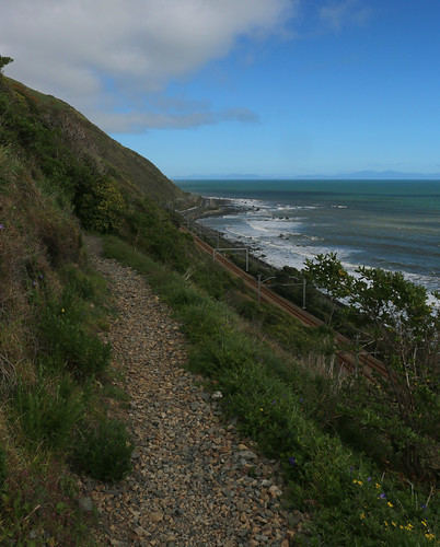
Clinging to the edge

The walk down Ames Street is probably recommended by the planners as it is more comfortable than the walk down the highway. So quiet you’d never know the highway and Main Trunk railway were right there – you hear the sea more! That said, the fact the traffic comes up quite fast behind you on the bridge is no fun.
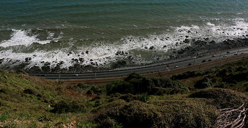
Dont look down

We enjoyed our walk heading south, and could see several advantages to tackling this section in a north-south direction. For starters, the sun was always behind us, or slightly to the side. Given that the ground was radiating warmth back at us in August, this track would get HOT in the summer. The wind (being northerly) was also slightly behind us for the most part, and we found that in large parts of the track it was actually fairly sheltered.
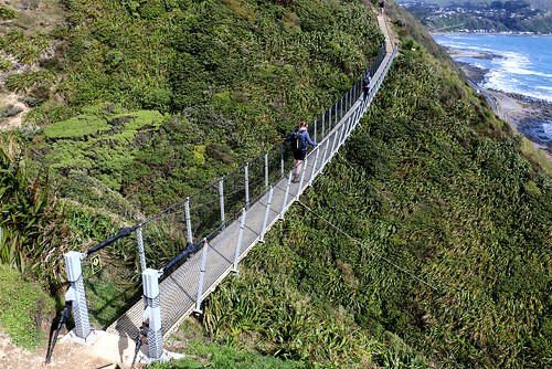
Overflight

Additionally, the stairs at the north end, while steep with narrow tread depth, have sections of benched track between them. The steepest climb from the south is incessant, with only landings between flights of stairs – although the treads seemed deeper on those as well. Getting the big climb out of the way earlier in the walk was also good, as we hit a bit tired on some of the later ones – and every climb had a matching descent, so hitting a long, steady stair climb late in the walk would have been really hard work.
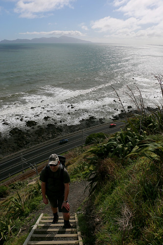
Keep on climbing

We met a really lovely large family group when we stopped at the lone, sheltered picnic table on the track, which was about 10 minutes shy of the first swing bridge. The picnic table was a great spot to stop, and easily sat 8 of us around it (with space to spare). It was entertaining watching them enjoy the swing bridge together.

By the time we got to the track-side track on the way to Muri Station, my feet were getting sore. While the ankle support offered by my boots was great for the stairs, the solid sole of my boots was too much for the kind of track it was. Doing it again I would probably throw a really light pair of running shoes in my bag for the pavement sections (about 1km at the start and end of the track), and still don boots for the track proper.

I was hoping for Muri station to be ominous and depressing in its closed / abandoned state, but perhaps its too soon, or the daylight was too strong.

There were a LOT of people out on the track with us. A couple of groups we leap-frogged as each took turns to stop, but most parties we saw ahead or behind us stayed ahead or behind us by about the same distance the whole track. A good number of runners were out. Probably 75% of the people we saw walking were going north to south, and passing was tight in a lot of places, with very little margin for error. I can imagine in high summer this track will be insanely popular, and I dread the idea of it turning in to a local variation on the Tongariro Alpine Crossing. The weather up there could change very rapidly (and it looked like it was threatening to, at least a couple of times while we were up there). There are no alternative exits – once you are on the track, it’s a through track or a back track for at least 8km. In summer heat it is VERY exposed and there are only small patches of shade and no water. People WILL turn up underprepared for the conditions, lulled into a false sense of security by how accessible it is.

Stunning track, will probably do it again at some point, and about this time of year – nice weather but not too hot!

Wednesday, 3 August 2016

Zealandia Faultline and Raingauge Spur tracks

 16 April 2016
Just me
7.4km, 1hr52min, total gain 229m, Visitor Centre to Visitor Centre, inside the sanctuary fence


I wasn’t feeling massively inspired this day, but we had no LJ at home for the weekend, and the sun was shining after a few days rain, so off I went while Mark did some work around the house and study. I was still aiming to finish my goal of red-lining all the tracks inside Zealandia, which I still haven’t completed, so off I launched into the back of the Upper Valley.

The best view I had all day
The faultline track was muddy. I seriously regretted opting for sneakers and shorts rather than boots and gaiters. It wasn’t overly surprising though, given the weather we had recently had, and the fact that the faultline track doesn’t see a lot of sunshine. I opted not to take the detour up the Western Firebreak for some reason that I cant recall now, perhaps I was running low on time, as I had only started walking at 2:30, and knew I had to be back at the visitor centre by 5pm, not knowing how long the loop around the back was going to take.

A burst of colour on the upper Raingauge Track
The track climbed gradually, with a couple of short steeper sections, until it got to the back fence. Unlike around the Brooklyn side of the valley, this part of the fence line track inside was actually moderately well defined. It was also quite steep (and so quite slow). I also found a surprise – a road around the back of the sanctuary. It looked to connect Brooklyn and Wrights Hills. The amount of undeveloped farm land to the south and west of the sanctuary was also quite a surprise. I sort of knew that the bottom of the island scooped around like it did, but at the back of the Faultline track, you feel like you are in the back of beyond – and then you look out and you are nowhere.

The raingauge track was also steep, and slippery in places, as well as starting to get quite overgrown with gorse and blackberry in places. I definitely wished I had gaiters and walking poles inching my way down the hill. The bottom of the track is very sudden – one moment you are in a dry, exposed bit of track, the next you are in the bush, and barely a moment later you are back on the faultline track, heading home again.

This leaves me with the Western and Eastern Fire Break and Tui Glen tracks to complete, and then I will have done all the tracks inside the fence except some sections of the clearing around the inside of the fence. Given the average condition of the “track” inside the fenceline, I’m not going to push to complete the last segments of that once I have done the others, instead I will do the loop around the outside one day.

Thursday, 28 January 2016

Zealandia – Fuschia Loop

30 September 2015
Just Me
4.59km, 1hr18min, total gain 184m, Visitor Centre to Visitor Centre


After many a time walking the main tracks of the valley, and dozens of trips up to the Upper Dam, with some free time up my sleeve I wanted to get really exploring the Valley. So a dream to walk every track on offer came to mind.

I started with what turned out to be the easiest loop – the Fuschia Loop. This track is designed to be walked as a loop, rather than as a there-and-back, or connecting to another track via the fenceline clearway.

On my way in, once I got up past the Upper Dam, I debated which way to go around the loop. Eventually I opted for counter-clockwise, with a plan to pop out to the end of the short Campbell Street Track while I was there.

The climb was moderate, but reasonably gradual, and all wonderfully shaded. Suddenly I came across a sign indicating it was 100m distance to the fence, as an optional side track, so I dumped my pack and took just my camera and myself up. The distance suggestion seemed way out of whack – I’m sure it was further than that.

Anyway, the VIEW from the top of the Fuschia Loop was INCREDIBLE – although the best spot to admire it from is about 50m along the fence back towards the visitor centre. Once I have completed my mission to walk all the tracks this is one I will certainly come back to. It is easily the best view out of the sanctuary I have found, as the fence doesn’t block the view like it does in other places. I could have sat there for ages if I hadn’t left my pack with my food and water back down the hill.

Back in the bush I got spotted by a kaka, that I gather may have been guarding a nest, as it followed me VERY closely as I continued down the track – never letting me get out of its sight for a good couple of hundred meters. Every time I got more than a dozen steps past it, it would fly over or around me and land just ahead of me. What an experience.

The track popped back out not far from where it had started. The track out to the fenceline at Campbell Street was flat (it was a bullock track back when there was mining and the dam was full) and short – only worth doing so I could say I had done it.

My return to the visitor centre was uneventful. To make things a little different I went across the dam and back along the tracks on the other side of the valley for a while as I headed back to the main path.

Definitely a highly recommended loop. I saw absolutely no-one in the half hour or so I was away from the main track, and it’s a great start to getting out into the “back” of the valley.


Monday, 30 November 2015

Zealandia Pylon and Turbine Tracks

20 October 2015
Just me
6.9km, 1hr44min, total gain 208m, Visitor Centre to Visitor Centre


For some reason I cant recall, in the morning I had parked on Thorndon Quay and walked up to Manners Street and back (4.1km!), so I am really surprised, looking back, that I even considered attempting such a loop.

Writing this well after the fact a handful of moments stick in my mind. It was hot. The whole walk. I was incredibly surprised at my capacity to just keep going – I remember remarking to myself that the me of 12-18 months previously would have got halfway up the hill to the pylon, decided it was both too steep and too hard, then turned around and gone home (since I was on my own). I carried my dSLR, only to discover at about the 2km mark that it had either no battery life or no memory card loaded (I cant remember which, but I do know it was a heavy, expensive, pack weight of no use).

Sitting under the pylon that the track is named for to catch a breeze and have a snack, the turbine looked fairly close, so I figured I would continue on and get my first taste of the track that is marked on the maps as running around the inside perimeter of the fenceline.

I wish I had taken photos of the track. It was absolutely not what I had expected. Overgrown, full of holes, and in places only wide enough for my feet with steep drops. It also had very little shade to offer. Some of the climb was also much steeper than I had anticipated, and I questioned regularly whether I would be better off turning around to go back or continue on.

I was determined to continue on, and so I did. Eventually the turbine appeared immediately in front of me. It took what seemed an interminable time. After stopping in the sun to take some selfies and have another bite to eat, I plunged down the steep upper section of the track into the cool bush, stopping partway down after startling a Tuatara back into its burrow.

The walk down the Turbine Track was uneventful otherwise and apart from a brief debate of whether to take the Tui Glen track or continue down the Turbine track (the Turbine track won), I was back on the main path before I really knew it.

Sunday, 1 March 2015

Stewart Island Day Walk

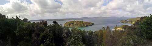
View from the lookout
 01 January 2015

Team: Mark, Spike, Me


Our holiday planning for our trip to the Catlins was nearly complete when Mark sprung on me the idea "we could go to Stewart Island". Wow. I hadn't even thought about the fact we were coming out of the Catlins in Invercargill - probably as close as we are going to get to Stewart Island for a long time coming.

We wanted to stay overnight, but the cost was prohibitive with a toddler, so we opted to do a day return instead, and just explore Oban and Patterson Inlet.

In the morning, it was cool and overcast. We wandered up from the wharf to the DoC office, where the lovely lady behind the desk highlighted half a dozen potential walks we could do as a family, either with Spike walking, or with us carrying him. We picked the longest for filling in the morning before our scheduled boat trip and headed off up the hills behind the town.

Our first bit of bush was a lovely reserve between the town and the rugby club. Then it was on, up the rather steep roads to the lookout at the top. Incredibly, after this Spike refused to get back into the backpack, and so walked all the way down the not-as-steep side of the hill, across the rugby ground and all the way to the end of the road, looking in to Patterson Inlet before deciding he was tired and wanted back into the backpack after all. During this time we saw a pair of kaka in the trees, which was rather magical.

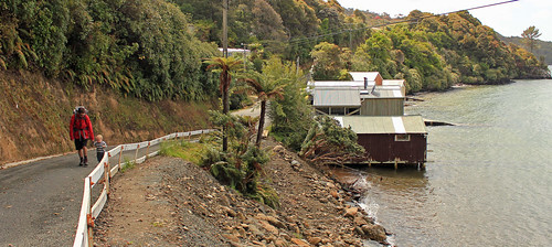
End of the road Into the secret garden

Back up and over the saddle, through the reserve again and down onto the waterfront for lunch.

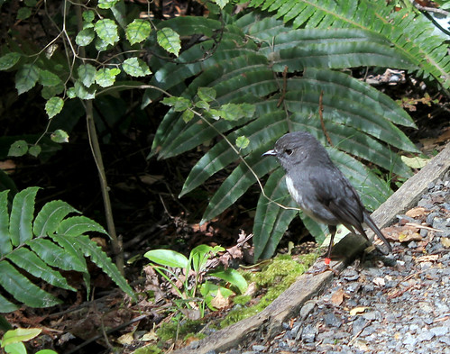
In the afternoon, as part of our Patterson Inlet cruise, we enjoyed a guided nature walk on Ulva Island, which is a bird sanctuary. Spike was very tired by this stage, so opted to stay in the backpack, where the slow pace and our guides lovely voice soon had him fast asleep. We got to see a whole range of unique plant species, and got up close and personal with a Robin. It was lovely.

Angst

After all that walking and Spike carrying, we were tired, so we opted to do a bus trip around the parts of the settlement we hadn't yet had a chance to see before we headed home.
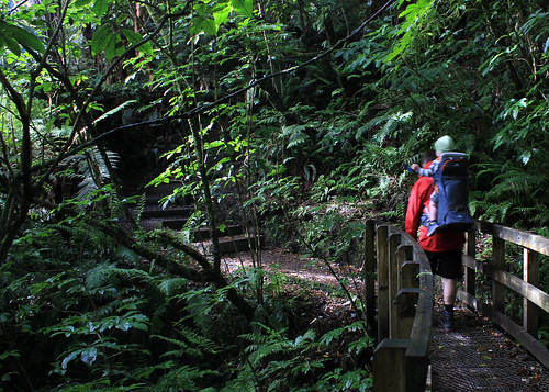
Bush Walk Sleeping Beauty

Monday, 15 December 2014

Goal Achieved

Monday 15 December 2014

Solo

Route: Ngaio Shops to Awarua St, up Bells Track to the Skyline. Climb to top of Mt Kaukau and back down via Simla Cres track. Return to Ngaio.

View to top of Bells Track from lower Awarua St
I've been meaning to get up Kaukau for a couple of months now, but events had continually conspired against me. Between toddler-at-home days, sickness and the awful weather we had in November, it looked like I wasn't going to manage it before Christmas.

Bells Track
The weather report for today was glowing - calm and warm. Awesome. I know from past experience that a light breeze around the suburbs means a bluster at the top of the hills, while still here is not still at the top. So after doing a chunk of our Christmas shopping in the morning, I headed off.

I opted to be a little lazy, and parked my car at Ngaio shops to save the 10 minutes walk each way. At the end of the walk I was so rediculously glad of this forethought! Whipping through Cummings Park at about 12:45, the climbing started almost immediately.
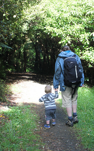
Traffic was quiet as I started up Awarua St, although there was a random surge of cars going past when I was nearly at the top. By the time I got to the top, I was incredibly glad that we had opted not to buy the house up there that we looked at the same day we saw our current place. I was also really hot, and realising that I probably could have left my jersey at home.

At the Skyline Walkway
The sign indicated half an hour to the Skyline Walkway, and 75 minutes to Mt Kaukau. It was 1pm. My friend Louisa had done a 7km loop up here and back in 1hr 45, so I thought perhaps the times were a little exaggerated.

Final climb to the top
It was a long, slow climb up the hill. I made it to the Skyline in about 17 minutes, and I thought I was pretty slow (and stopping frequently, both to admire the view, and to rest). I continued what seemed to be ever upwards towards Mt Kaukau, standing at the bottom of the final grunt to the transciever at 1:45, and making it to the top at just on 2pm.

View to Tappy
I spent a few minutes sitting underneath the viewing platform, trying to cool down a little from the heat, and watching the herd of cows that were hanging around, seeming pretty docile, but huge and seeming slightly threatening none-the-less.

I toyed with the idea of going around behind the transciever to actually bag the trig at the proper top of the hill, but decided against it in favour of getting home for a cool shower.

A quick mission down to Simla Cres (which actually seemed to take ages, and every time I looked down to where I was headed, it looked forever away), and then a whip along Khandallah Road, and I was stopping at the dairy to buy an icecream, before being back at the car just before 2:45.

So, just under 2 hours, including breaks, just under 6.5km travelled. Total climb 317m.