Turere Lodge, Orongorongo Valley, Rimutaka Forest Park
Me, Mark, Spike, Emily, Ivan, T, M, Amelia S, A, C, Marion, E.
3-4 December 2016
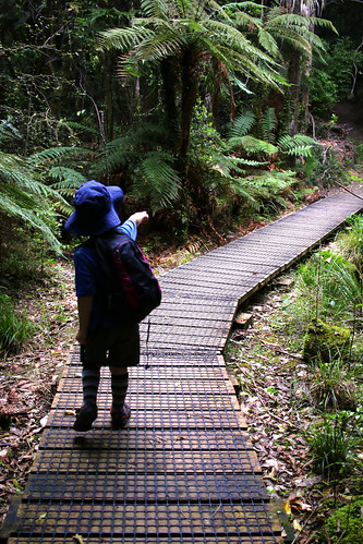
Planning for this started months ago. Not long after the really challenging overnighter we took Spike on to Waihohonu Hut in February. Because you have to book a stupid amount of time in advance if you want to reserve the entirety of Turere Lodge for a weekend night! Originally we had thought about doing this around my birthday, but by the time we booked in about late April, the first weekend of December was the first weekend exclusive occupancy was available.
We sent out the invite to about 8 friends who had kids (and a couple who didn’t), hoping to get 4-6 families total into the 32-bed, 4-room lodge. Eventually, after a couple of late pull-outs, and the addition of a family grabbed from the Tramping Club Families group, we had 4 families – 6 adults, 3 3-year-olds and 3 5-year-olds. What a group. What an appetite for chaos we all had!
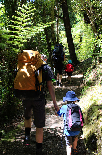
Turns out, this was a fantastic sized group. We could all amble along at different paces, taking turns to keep an eye on each others kids. The kids kept each other motivated and moving, and even though it turns out there is a LOT of up hill going in to Turere Lodge, the kids all walked most, if not all, the way in.
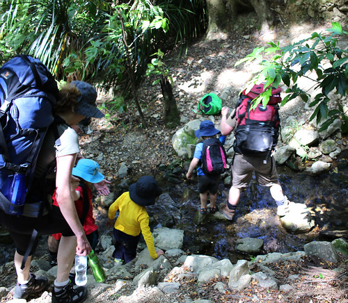
After a late start at the carpark of nearly 2pm, it was after 5:30 by the time we got to the hut and got the rooms unlocked. Dinner was started immediately, to the sound of kids running around screaming. They all ate something at least, although some were too tired to eat much. After a shared pudding of chocolate cake, strawberries and custard, we started working on persuading them all to go to bed. Unsurprisingly, Spike was last to go to sleep, finally drifting off not long before we all headed to bed.
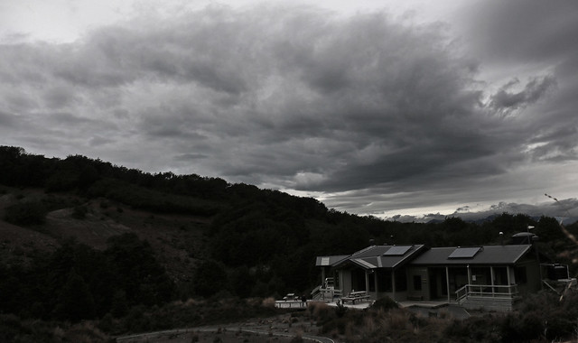
While Turere is a wonderful hut, and its awesome to not have to bring cooking or eating gear, the mattresses are in desperate need of replacement. I wound up getting up at about 2am and pulling down a second mattress. Mine was more air than filler inside its cover! But honestly, that’s my only complaint – the hut was warm without heating, there was loo roll in the toilets and hand sanitiser at the basin. It was clean and tidy.
Sunday morning rolled around FAR too early for anyones liking. We stumbled through breakfast on the deck (having forgotten the brown sugar for our porridge), threw our gear in our packs, grabbed a team photo on the deck and headed off about 8:30am. Despite the bulk of the walk being downhill on the way home, it still took as long to get back – poor tired legs and all.
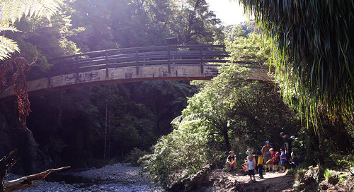
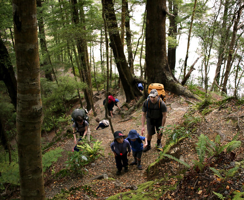
The kids all excitedly climbed up Jacobs Ladder instead of the newer benched track until the two crossed again, so that we could promise them a break at the seat 7/8ths of the way up the hill. From there, we stopped again at Macs Hut briefly, then continued on. Around Midway Bridge, the younger kids started to significantly flag, so elephant rides became a routine sight and bribery became an essential component in keeping moving.
We also regularly leap frogged a family group who had stayed on a hut across the river, including a mum wearing an old Mountain Mule that looked painful, even with a jersey wrapped over her shoulders as extra padding under the straps.
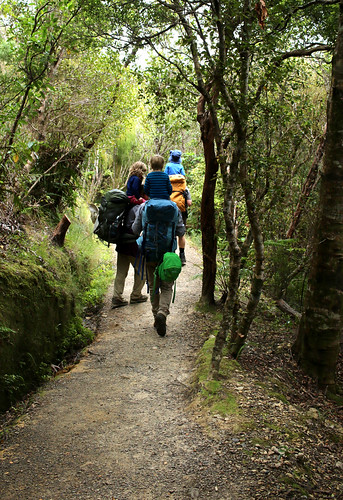
Arriving at the road end with very tired kids just as it started drizzling at about 12:15 was a relief. A quick toilet break, change of clothes / shoes and we were all off. McDonalds for lunch was a failure as Spike was so tired we should have let him sleep instead, as he didn’t eat.
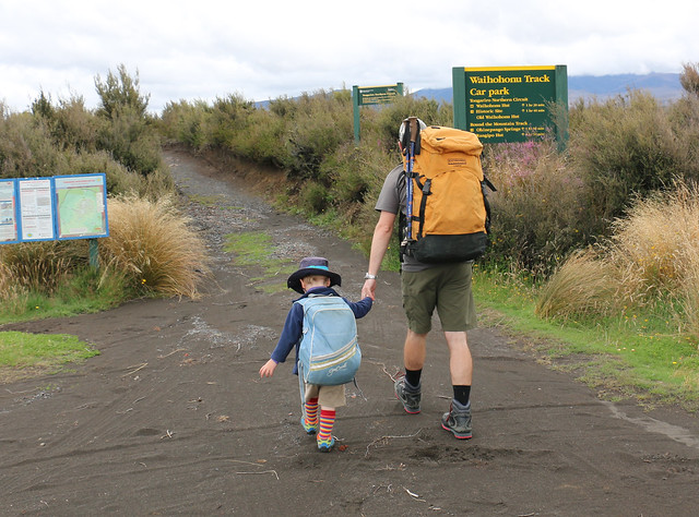
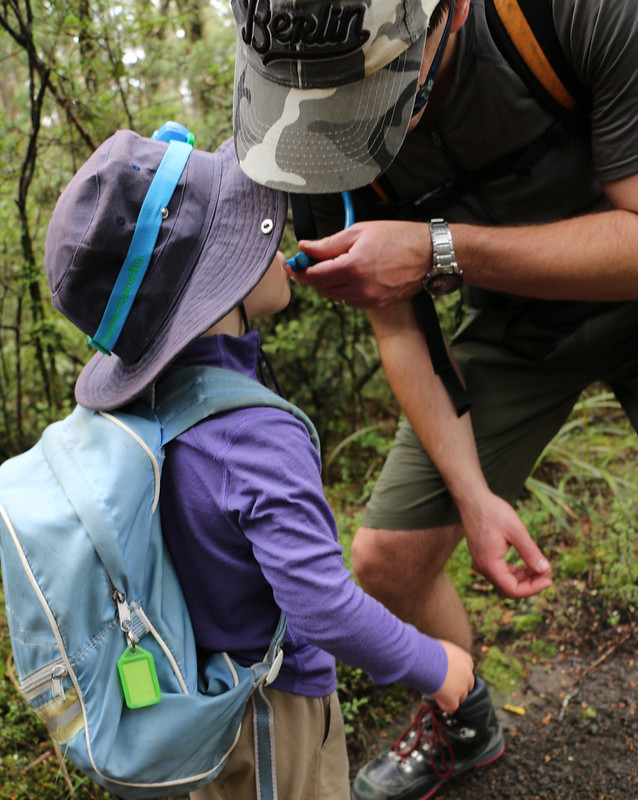
A great time was had, and the parents are all discussing doing it again to somewhere else (maybe Atiwhakatu) when the kids are another year or so older. Spike loved carrying his little bag (this one was better sized for him than the one we tried in February), and we are looking forward to him using it again, perhaps with more than a bottle of sunscreen and a whistle next time!
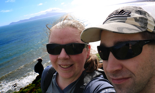
Huts are wonderful things - shelter from the storm and places memories are made. here are some in Beautiful New Zealand - Godzone
Thursday, 15 December 2016
Sunday, 27 November 2016
Climbing a Stairway to Heaven
28-Aug-2016
Mark, Myself
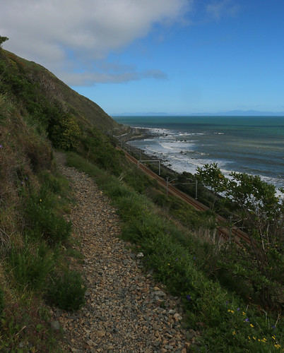
Paekakariki Escarpment Track, Te Araroa Trail, Paekakariki Train Station to Pukerua Bay Train Station
9.74km, 3hr08min, 364m elevation gain
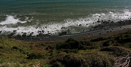
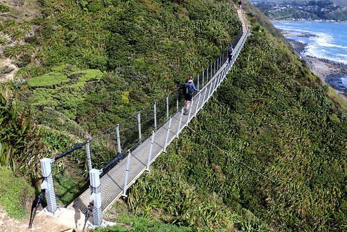
A fair while ago, I noticed a couple of swing bridges well above State Highway 1 along the coast, and wondered how to get to them. Mike made an attempt back in 2013, before the track was completed and opened, and ever since I have been waiting to try the track for myself. (Mike also did it more recently – in fact, the day after it opened)
Once the word was out that the final stages of track building were underway and the track would have a grand opening, it moved well up my to-do list for local daywalks. Trying to find a time when we have been around with no other plans, good weather, no injuries and no pre-schooler to hand has been a challenge, although things finally happened on the weekend.
The forecast was for fine, warm-but-not-hot weather with northerly breezes. With what I knew of the narrowness and exposure of the track, the fact moderate breezes were forecast did make me a little nervous, but I figured at least a northerly would blow UP the hill, not down, given the alignment of the hills.
We headed out the door at just after 9am, having decided to park our car at Pukerua Bay station and catch the train north to Paekakariki and then walk south (which was the recommendation on the opening day, and seems to be the recommendation in general, we definitely understood why later). For reference, the trains come through Pukerua Bay every half hour at 10past and 20to the hour north AND south bound, and its about 10 minutes to Paekakariki ($3.50 cash fare).
The track starts at the train station, heading up Beach Road towards the beach, then turning at the church (take advantage of the toilets, you wont see more until you get to the main road at Pukerua Bay), and wandering down the footpath along Ames Street for about 1km till you turn back NORTH up the highway, across the narrow bridge (be aware of trucks, that bridge is narrow and they are RIGHT THERE when they surprise you), and down the stairs at the north end, under the bridge to the 1km marker.
The walk down Ames Street is probably recommended by the planners as it is more comfortable than the walk down the highway. So quiet you’d never know the highway and Main Trunk railway were right there – you hear the sea more! That said, the fact the traffic comes up quite fast behind you on the bridge is no fun.
We enjoyed our walk heading south, and could see several advantages to tackling this section in a north-south direction. For starters, the sun was always behind us, or slightly to the side. Given that the ground was radiating warmth back at us in August, this track would get HOT in the summer. The wind (being northerly) was also slightly behind us for the most part, and we found that in large parts of the track it was actually fairly sheltered.
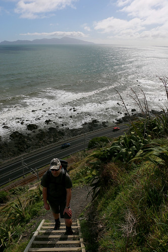
Additionally, the stairs at the north end, while steep with narrow tread depth, have sections of benched track between them. The steepest climb from the south is incessant, with only landings between flights of stairs – although the treads seemed deeper on those as well. Getting the big climb out of the way earlier in the walk was also good, as we hit a bit tired on some of the later ones – and every climb had a matching descent, so hitting a long, steady stair climb late in the walk would have been really hard work.
We met a really lovely large family group when we stopped at the lone, sheltered picnic table on the track, which was about 10 minutes shy of the first swing bridge. The picnic table was a great spot to stop, and easily sat 8 of us around it (with space to spare). It was entertaining watching them enjoy the swing bridge together.
By the time we got to the track-side track on the way to Muri Station, my feet were getting sore. While the ankle support offered by my boots was great for the stairs, the solid sole of my boots was too much for the kind of track it was. Doing it again I would probably throw a really light pair of running shoes in my bag for the pavement sections (about 1km at the start and end of the track), and still don boots for the track proper.
I was hoping for Muri station to be ominous and depressing in its closed / abandoned state, but perhaps its too soon, or the daylight was too strong.
There were a LOT of people out on the track with us. A couple of groups we leap-frogged as each took turns to stop, but most parties we saw ahead or behind us stayed ahead or behind us by about the same distance the whole track. A good number of runners were out. Probably 75% of the people we saw walking were going north to south, and passing was tight in a lot of places, with very little margin for error. I can imagine in high summer this track will be insanely popular, and I dread the idea of it turning in to a local variation on the Tongariro Alpine Crossing. The weather up there could change very rapidly (and it looked like it was threatening to, at least a couple of times while we were up there). There are no alternative exits – once you are on the track, it’s a through track or a back track for at least 8km. In summer heat it is VERY exposed and there are only small patches of shade and no water. People WILL turn up underprepared for the conditions, lulled into a false sense of security by how accessible it is.
Stunning track, will probably do it again at some point, and about this time of year – nice weather but not too hot!
Labels:
2016,
Daywalk,
Te Araroa Trail,
Wellington
Location:
Paekakariki 5034, New Zealand
Wednesday, 3 August 2016
Zealandia Faultline and Raingauge Spur tracks
16 April 2016
Just me
7.4km, 1hr52min, total gain 229m, Visitor Centre to Visitor Centre, inside the sanctuary fence
I wasn’t feeling massively inspired this day, but we had no LJ at home for the weekend, and the sun was shining after a few days rain, so off I went while Mark did some work around the house and study. I was still aiming to finish my goal of red-lining all the tracks inside Zealandia, which I still haven’t completed, so off I launched into the back of the Upper Valley.
The faultline track was muddy. I seriously regretted opting for sneakers and shorts rather than boots and gaiters. It wasn’t overly surprising though, given the weather we had recently had, and the fact that the faultline track doesn’t see a lot of sunshine. I opted not to take the detour up the Western Firebreak for some reason that I cant recall now, perhaps I was running low on time, as I had only started walking at 2:30, and knew I had to be back at the visitor centre by 5pm, not knowing how long the loop around the back was going to take.
The track climbed gradually, with a couple of short steeper sections, until it got to the back fence. Unlike around the Brooklyn side of the valley, this part of the fence line track inside was actually moderately well defined. It was also quite steep (and so quite slow). I also found a surprise – a road around the back of the sanctuary. It looked to connect Brooklyn and Wrights Hills. The amount of undeveloped farm land to the south and west of the sanctuary was also quite a surprise. I sort of knew that the bottom of the island scooped around like it did, but at the back of the Faultline track, you feel like you are in the back of beyond – and then you look out and you are nowhere.
The raingauge track was also steep, and slippery in places, as well as starting to get quite overgrown with gorse and blackberry in places. I definitely wished I had gaiters and walking poles inching my way down the hill. The bottom of the track is very sudden – one moment you are in a dry, exposed bit of track, the next you are in the bush, and barely a moment later you are back on the faultline track, heading home again.
This leaves me with the Western and Eastern Fire Break and Tui Glen tracks to complete, and then I will have done all the tracks inside the fence except some sections of the clearing around the inside of the fence. Given the average condition of the “track” inside the fenceline, I’m not going to push to complete the last segments of that once I have done the others, instead I will do the loop around the outside one day.
Just me
7.4km, 1hr52min, total gain 229m, Visitor Centre to Visitor Centre, inside the sanctuary fence
I wasn’t feeling massively inspired this day, but we had no LJ at home for the weekend, and the sun was shining after a few days rain, so off I went while Mark did some work around the house and study. I was still aiming to finish my goal of red-lining all the tracks inside Zealandia, which I still haven’t completed, so off I launched into the back of the Upper Valley.
The best view I had all day |
A burst of colour on the upper Raingauge Track |
The raingauge track was also steep, and slippery in places, as well as starting to get quite overgrown with gorse and blackberry in places. I definitely wished I had gaiters and walking poles inching my way down the hill. The bottom of the track is very sudden – one moment you are in a dry, exposed bit of track, the next you are in the bush, and barely a moment later you are back on the faultline track, heading home again.
This leaves me with the Western and Eastern Fire Break and Tui Glen tracks to complete, and then I will have done all the tracks inside the fence except some sections of the clearing around the inside of the fence. Given the average condition of the “track” inside the fenceline, I’m not going to push to complete the last segments of that once I have done the others, instead I will do the loop around the outside one day.
Labels:
2016,
Daywalk,
Wellington,
Zealandia
Location:
Wellington, New Zealand
Sunday, 26 June 2016
Spikes first "tramp"
Waihohonu Hut, Desert Road, Tongariro National Park
Team: Mark, Spike, Me
Date: 06-07 Feb 2016
Unfortunately, this meant long-weekend Friday night traffic to get out of town, and we made the mistake of trying going via Masterton instead of straight up the coast. Given Spike slept all the way to Masterton, sitting in traffic for a similar time to get to Levin would have been fine. We ran into the club van, headed for Tukino, at Taihape – they had left an hour after us.
Spike then stayed awake all the way to our nearly-midnight arrival at the lodge, and took a chunk of persuading to go to sleep, even once the lights were off and Mark and I were nearly asleep ourselves.
Bookending our night at the hut with nights at the lodge meant we could leave fresh food and non-tramping belongings behind while we tramped, rather than having to leave things in the car.
Having the lodge to ourselves also meant that we didn’t have to worry about disturbing anyone.
Saturday morning arrived with indecent haste. We only had an hours drive and about 2.5 hours walk ahead of us for the day, so there was no rush, but we also wanted to be at the hut at a reasonable time, in order to attempt to snag a set of bottom bunk mattresses together. Lunch was made, water bladders were filled, packs were packed (and seemed indecently full for a single night trip). It was cool and drizzly at the lodge, with an average forecast so we dressed accordingly, locked up and wandered down to the car.
The forecast was wrong. While it never actually rained, it stayed overcast. So instead of being cool and wet, and it was stuffy and muggy. Not the best weather for getting the best movement out of a not-quite 3 year old who doesn’t like to walk long distances anyway!
Liberal applications of food, water, and lollies, along with several sessions where Mark and I carried Spike on our shoulders on top of our packs as well, still didn’t get us to the hut before Mark and I started hitting spent, and Spike started melting down. So I raced ahead to dump my pack and then come back to carry Spike the last chunk in the Tula we had bought for this purpose. Incredibly, Spike perked up and started moving at a reasonable clip once he was down to only being with Mark, and so my carry wasn’t that far.
Spike perked up once we were at the hut, charming everyone, eating anything he could get his hands on, and running around everywhere constantly. Dinner was roundly ignored, as was dessert, but while we could tell he was tired, he refused to go to sleep until it was dark – the same time the last of the adults went to bed.
Sunday morning dawned deathly early. We really should have bought the blackout blind to the hut. Thankfully, Spike was tired enough to go back to sleep for another half hour / 45 minutes to a time when more of our hut mates were also waking up.
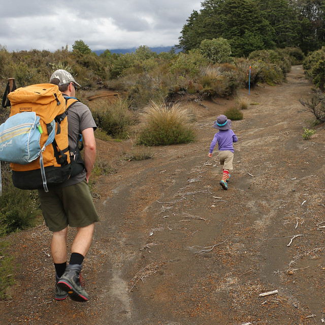
The weather had cleared overnight and we were greeted by clear skies and cooler temperatures. Spikes enthusiasm for walking died after a very short time, and we had used the bulk of our lolly stash getting to the hut. Two nights of poor sleep were also telling on our tempers. Tantrums were had (both toddler and adult ones), carries were given, threats were made to leave Spike behind (I couldn’t do it. If he wandered off track we would never find him).
When we got to the last segment before the car, we reversed the day before and sent Mark off to dump his pack and come back to collect. Again Spike picked up the pace markedly when there was only one adult around, and Mark barely managed to turn around before we were there.
More food was divvied out and we headed to Turangi for an early lunch and a swim in their indoor pools (which were both cheap and wonderfully refreshing), before heading back to the lodge for an early dinner and early night.
Thankfully, Mondays drive home was drama-free. We stopped in Ohakune and Levin for food, playgrounds and icecreams.
I wont lie – this trip was HARD work. We definitely over-estimated how interesting the track and surrounds were for a pre-schooler. And I think the distance was a little far. But we’ll try again, for sure.
Thursday, 28 January 2016
Zealandia – Fuschia Loop
30 September 2015
Just Me
4.59km, 1hr18min, total gain 184m, Visitor Centre to Visitor Centre
After many a time walking the main tracks of the valley, and dozens of trips up to the Upper Dam, with some free time up my sleeve I wanted to get really exploring the Valley. So a dream to walk every track on offer came to mind.
I started with what turned out to be the easiest loop – the Fuschia Loop. This track is designed to be walked as a loop, rather than as a there-and-back, or connecting to another track via the fenceline clearway.
On my way in, once I got up past the Upper Dam, I debated which way to go around the loop. Eventually I opted for counter-clockwise, with a plan to pop out to the end of the short Campbell Street Track while I was there.
The climb was moderate, but reasonably gradual, and all wonderfully shaded. Suddenly I came across a sign indicating it was 100m distance to the fence, as an optional side track, so I dumped my pack and took just my camera and myself up. The distance suggestion seemed way out of whack – I’m sure it was further than that.
Anyway, the VIEW from the top of the Fuschia Loop was INCREDIBLE – although the best spot to admire it from is about 50m along the fence back towards the visitor centre. Once I have completed my mission to walk all the tracks this is one I will certainly come back to. It is easily the best view out of the sanctuary I have found, as the fence doesn’t block the view like it does in other places. I could have sat there for ages if I hadn’t left my pack with my food and water back down the hill.
Back in the bush I got spotted by a kaka, that I gather may have been guarding a nest, as it followed me VERY closely as I continued down the track – never letting me get out of its sight for a good couple of hundred meters. Every time I got more than a dozen steps past it, it would fly over or around me and land just ahead of me. What an experience.
The track popped back out not far from where it had started. The track out to the fenceline at Campbell Street was flat (it was a bullock track back when there was mining and the dam was full) and short – only worth doing so I could say I had done it.
My return to the visitor centre was uneventful. To make things a little different I went across the dam and back along the tracks on the other side of the valley for a while as I headed back to the main path.
Definitely a highly recommended loop. I saw absolutely no-one in the half hour or so I was away from the main track, and it’s a great start to getting out into the “back” of the valley.
Location:
Wellington, New Zealand
Saturday, 16 January 2016
Summer Camping at Martinborough
27 December 2015 - 02 January 2016
Team: Mark, Spike, Me
Martinborough Top 10 and greater Wairarapa area
We ummed and ahhed for a really long time about this camping trip last year. Did we go? Where should we go? We originally planned Rotorua, but the campground we wanted was booked out by the time we made a decision. So we thought more laterally, and wound up at Martinborough Top 10 – nice and close to home, but still far enough away to make it an adventure.
We chose the Top 10 because we wanted facilities – hot showers, cookers provided, powered sites, playground equipment – rather than seeing about joining other friends at their annual site up the road which was a farmers back paddock. And the Martinborough one didn’t disappoint (we had been there as a couple for a wedding, so we knew what we were looking at).
The weather was stunning when we arrived, and tent pitching didn’t take too long at all. Our site had morning sun and afternoon shade. While we wished we had bought the blackout blinds to darken things a bit more for better sleep, it was nice that the tent stopped heating up not long after lunchtime, so was a comfortable temperature for sleeping in at night. Tenting with a toddler, we anticipated later nights and early mornings, but they largely weren’t too bad, and we even managed a couple of nights to get some time to ourselves to enjoy wine and cheese at the picnic table adjacent to our site.
We spent a lot of time just chilling out at the campground as a family and with Rebekah (a friend from playgroup) and her family. It was bliss. Between the campground, the nearby school playground, bike rides around town and the pool next door, our days were reasonably full.
We only had two outing days while we were there. The first was to Mt Bruce, inspired by our quest to capture all the “Wild Things” that were around the region. It was a lovely, quiet spot. Not as good as Zealandia, although its biggest advantage was how friendly the kaka were – you had to actively stop them from stealing your food if sitting outside at the cafĂ©, which was a very neat experience.
Our other outing was New Years Day, when we took the car out to Cape Palliser and the Putangirua Pinnacles. It was HOT and both walks were challenging in our slightly-tired state. I wound up with Spike on my back climbing the 200-something stairs up to the lighthouse at Cape Palliser, which was a workout and a half. We stopped for ice-creams on the way back at Ngawi and they were MASSIVE and awesome.
Late evening on New Years Day it started drizzling. Our first rain of the trip. And it just got heavier overnight. New Years Day Holiday dawned overcast and wet, and we somewhat regretted the fact we hadn’t opted to head home the evening before while our tent was still dry. Several more wet weather days followed while we tried to get the tent dry and laundry sorted, which was probably the biggest challenge of the entire experience!
All told, we learnt some good lessons about camping as a family, and will take those in to this summers camping trip. Here’s hoping we can make it a regular experience for most summer holidays!
Location:
Martinborough, New Zealand
Subscribe to:
Posts (Atom)