Wednesday, 1 May 2019

The Tide Waits for no Man (or Kayak)

Abel Tasman Kayaks, Onetahuti to Marahau
23 – 25 April 2019
Amelia & Mark


This part of our April adventure came about in a rush at short notice. We didn’t get the Kaiteriteri Holiday House we wanted in the ballot, so had to come up with an alternative plan. In the end, we flew Spike to Christchurch to stay with his grandparents and cousins for the week, and we grabbed a rare opportunity to have an adventure together that was a bit different.
Ready to launch

In December last year, we were down to co-lead a kayak trip for the tramping club in Kenepuru Sound. We had to cancel that trip when Mark broke his collarbone at the end of September and we couldn’t find a replacement co-leader without paying the hire company.

With a week to play with, we looked at a host of options – walking some or all of the Heaphy Track (booked out at the huts, only awkwardly placed campsites available), walking the north end of the Abel Tasman from Bark Bay (same thing, especially awkward with tides) – and eventually settled on hiring a kayak. We considered doing a multi-day guided kayak, but in the end our cheap sides won out and we went with freedom rental instead.

Mosquito Bay, mid-tide
Our freedom rental involved a drop-off at Onetahuti beach and two nights camping accommodation at any site we wanted to (which Abel Tasman Kayaks would book on our behalf). Going this way works with the prevailing winds and tides in the area, but what we didn’t realise was that this meant we didn’t get to load our kayaks until we were at the beach, so had to guesstimate whether what we had would fit.

Looking at our rather large pile of stuff, we were a little worried. It looked like an absolute mass of gear and food, and the spaces in the kayak just didn’t seem that large.

Our water taxi ride out to Onetahuti was uneventful. It started raining a little as we hit the beach, so we packed up reasonably quickly and headed off onto the water, rather than going for a walk or much of an explore. It turned out that our gear fit easily into the kayak, with space to spare. So now we know for any future trips.

Mosquito Bay, low tide
The tides had turned right around since we had been walking the week before, and now low tide was closer to dawn and dusk rather than mid-day. So we made our way directly around and over the reefs to our nights campsite at Mosquito Bay (only accessible by water), and unpacked our kayak, pitched our tent and stowed our stuff. Then we jumped back in the kayak and headed out to go for a paddle in the Bark Bay estuary, just because we could. We bottomed out a couple of times as the tide was receding rapidly, but got back out before we had to portage.

By the time we got back to Mosquito Bay, the tide had gone a LOOONG way out and we had to portage the (thankfully largely empty) kayak quite some distance. Not so far as some of the other groups who arrived later did though, as the tide continued to drop. We racked our kayaks, cooked up some dinner and chilled out to watch the sunset, catching up in the meantime with a solo kayaker who had been in the OUTC with me back in the day.

Bark Bay
Wednesday morning dawned clear, with a damp tent and what looked like a long wait for the sun to come around to the campsite. The size of the tide movement in the area was really clear when we were preparing to portage our kayak. This day, the high tide was at 3.9m, with the low tide at 0.3m – a 3.6m difference. We clambered over some rocks on the island in the middle of the bay to explore and then set off, aiming to hit the Torrent Bay estuary some time around high tide (11:42am).

Before getting there though, there was Frenchmans Bay estuary to explore. Sadly, we hit this one WAY too early, and there was barely depth to get us anywhere. It was gorgeous and so peaceful though, just as we expected having looked into it on our walk the week before.

Torrent Bay
To avoid doubling back (we wanted lunch at Anchorage hut), we wound up in Torrent Bay estuary a little early. This was great for getting in, as the water pushed us through the gap and we barely needed to paddle. We managed to kayak nearly all the way to the back of the estuary, where we had walked the week before to do Cleopatras pool. Coming back out was a slightly different challenge – the tide was still pushing in with some force, and we had to work hard to avoid being pushed around too much.


After lunch and refilling of water bottles at Anchorage Hut (the place felt like home after two nights there the week before), we chilled out for a bit in the sunshine. We’d done the bulk of our days paddle by now, but the most exposed bit of the day was still to come, and the advice we had was that this section tended to be most sketchy later in the afternoon.

We were the first boat to arrive at Observation Beach. On the brochures, its marked as being boat access only, but at some point in the last couple of years, a track has been built and its now accessible from the coastal track. We set up our tent, tidied away our kayak and went for a walk up the hill – I gave up about 2/3 up the hill because that was far enough!

Another lovely night, including watching the ISS fly over, and suddenly it was our last day. We warmed up in the morning by wandering around to the next cove (accessible via the beach at lower tides) where the sun was, then paddled straight out to Adele Island to see the seals.

Lunch at Apple Tree bay included a long walk to the far end of the beach and back to waste some time, and we were still back at Marahau about 2pm, having abandoned plans to go around to Split Apple Rock because we were tired and the weather was packing in.

We timed this perfectly, as there was a couple of staff from the kayak firm hanging around at the boat ramp when we arrived, so our kayak was on the trailer and we were back at the depot to unpack, clean up and have showers within a few minutes.

This trip was AMAZING. Can’t wait till Spike is 12 so we can go and do it again as a family – albeit maybe taking a bit longer.

Tuesday, 30 April 2019

Making New Friends

Abel Tasman Coastal Track, Bark Bay to Marahau
17 – 20 April 2019
Party: Mark, Spike, Me

 
A few weeks prior to departure, I got the devastating email from Lisa that her boss wasn’t allowing her leave to bring her two boys up and walk with us. Given the short notice, we weren’t able to find anyone to take her place either, leaving us a little anxious that Spike would be hard work with no other kids to walk with.

Obviously, we still went anyway.

Our ferry sailing and drive through to Motueka both went smoothly. The Motueka Top10 has changed a bit since Mark and I were last there (in about the summer of 2011), but not massively so. The large, park-like gardens were basically empty, opening up masses of space to run around in on our day off.

When we arrived at our water taxi depot in Marahau on the Wednesday morning, we discovered that they actually did offer gear portage – but we had packed in such a way that this wasn’t feasible for us to arrange with super short notice. Looking later at their website, to figure out how we had missed this essential piece of planning information, we could not find a single reference to it. It seems that if you don’t pick up one of their printed brochures while doing your planning, you’ll never know.

The ride out to Bark Bay was somewhat bumpy, but not massively so. We arrived as the tide was well into its drop to low tide, so had to be dropped at the far end of the beach, leading to about 10 minutes of slog through the soft, grainy sand, to the hut itself. Wandering inside, we found we were among the first to arrive for the night, so nabbed a trio of mattresses before enjoying lunch on the deck.

To fill in our afternoon, we went for a walk to a swing bridge and waterfall, and explored the estuary.
After a scrummy dinner (eaten under the watchful eye of a couple of weka), Spike had an early-ish night, and Mark and I got to know some of the others in the hut with us. There were a lot of kiwis in residence, which was lovely.

Thursday dawned fine, and after watching some of the others having a swim in the estuary, we headed off, allowing ourselves as much time as possible for our 8.5km day. We opted to stop and explore Sandfly Bay on our way through, and took our time heading up the hill from the swingbridge just past there.

We timed things nicely, arriving in Torrent Bay about half an hour before full low tide. We sat by the wharf and ate a relaxed lunch before making our way across the estuary. The last up and over the hill to Anchorage was easier than I remembered, and we were among the first 10 or so people to arrive at Anchorage Hut for the night, getting awesome bunks.

Another relaxing afternoon stretched before us. We watched guided walkers wander in and out, and a group of canyoners do the same. The hut filled up, and the lights came on as the sunset dropped.

Watching everyone leave on Friday, knowing we had a full day up our sleeves to do whatever we wanted was an unusual sensation. But the peace at the hut between departure time and the arrival of the first day walkers was gorgeous. We wound up doing two walks – in the morning out to Pitt Head (don’t bother, the views aren’t that amazing), and in the afternoon out to Cleopatras Pool, via the high tide track there, and the estuary back.

The climb out of Anchorage on Saturday morning was unrelenting. We were glad to have made a reasonably early start as it was exposed and very warm on our way up the hill. The going was super slow (not helped by how much walking we had inadvertently done on our “day off”). Spike super hit the wall all day, and it was just hard going.

We stopped at several of the bays along the way for toilets and rest, enjoying being watched by weka. Thankfully this day had regularly spaced markers for trapping boxes that counted down to the end of the track at Marahau – finding these was all that kept Spike putting one foot in front of the other. To be honest, by the end of the day, I felt about the same.

The last couple of km from Tinline Bay campsite to the Marahau road end were just depressing. We should have dropped out on to the beach and taken the low-tide route, but we weren’t confident of it. Instead we ducked and weaved, climbed and dropped, never seemed to get any closer till we were on the bridges.
 

We grabbed our car, changed into more comfortable shoes, and headed off back to Kaiteriteri, where we were staying for the night. Hot showers, clean clothes, dinner cooked for us, and real beds. Exactly what was needed to wrap up this trip. We were super proud of how Spike had done over our four days on the track. We’re keen at some point to go back as a family and walk the northern end of the track – Bark Bay to Whariwharangi Hut, but that’s maybe a few years away yet.


Saturday, 23 March 2019

Up the side of a volcano

16-17 March 2019
Party: Mark, Spike, Me
Whakapapa Skifield, Tongariro National Park

 
As part of my volunteer role with the club ski lodge, I urgently needed to do a detailed stock take of the dry food stores in the pantry in time to sort out the bulk food delivery for mid-May. So, despite the barely-recovered jetlag from the previous weekends trip to Melbourne, we loaded up the car and drudged our way north on a Friday afternoon.
To help keep spirits up, we tried starting with a walk via the river to Taranaki Falls in the morning. This was a complete failure as Spike just did not want to walk anywhere. We headed back to the lodge and promised we'd try going out again after I'd finished the stock take instead.

Thankfully, the stocktake didn’t take long and the weather was pretty reasonable. So once I had the bulk of the stocktake completed, and after we had spent some time admiring the work of the helicopter that was dropping off roofing iron on the neighbouring lodge, we headed off to explore.

We started at the carpark at the Top of the Bruce, where we had the first opportunity to see the construction of the base station for the new gondola. The massive red crane that was in place was impressive to everyone. The carpark area was busy – it appeared we had stumbled upon a work party weekend for multiple other lodges – with cars, people, and loads of stuff hanging around in piles.

After watching a large tractor with a trailer head through the cordon and start making its way up the Rock Garden, we wandered off to the large map that told us how we could still access the upper sections of the mountain. Normally at this time of year, such a walk would literally go straight up the graded track from behind the café, and continue up to Knoll Ridge. This summer, the track instead was a series of poled plot points, winding its way up and over the rocks to the side of the ski field.

Astoundingly, Spike was excited about climbing over rocks and hunting out the next flagged pole for us to walk to. We meandered our way over the rocks and up the hill for a while, making it up and around the Tongariro Ski Club lodge, then up and across a waterfall that marks the exit of the Tennants Valley Run. In the end, we made it to well within sight of the Tararua Tramping Club lodge before we persuaded Spike that it was time to head back down to the our lodge for a drink and some afternoon tea.

We largely returned the same way, although instead of dropping back down to the carpark then climbing back up our track, we scrambled over and around another couple of lodges and dropped onto the old 4WD track that runs along our ridge (which comes out down by Carpark 5).

Since the weather was fine on Sunday morning, we repeated our escapade. This time we started by going up the 4WD track for a short distance, before rock hopping our way back up to the waterfall again. Now that we knew where we were going, this took a chunk less time than it did on Saturday.

Returning via a non-route through a gully that is popular for sledding in the winter, we picked up an ice cream container that had been dropped, and filled it with rubbish we found alongside the stream. We stopped in at the rubbish depot to drop this off before returning to the lodge to lock up and head home.

Friday, 30 November 2018

Beating the weather

Cannibal Gorge Hut, St James Walkway. Lewis Pass return.
Party: Me, Jane, Anne, Anna, Ed, Sophie (WTMC Trip)
16 – 18 November 2018

 
This was easily the furthest I have ever travelled for a simple weekend tramp. While I had a great crew, I think I’d only go that far for a long weekend in the future.

Friday afternoon we all met at the railway station, jumped in the van and whipped down the road to check in to our ferry. The sailing was smooth and we all enjoyed a good dinner in each others company. Arriving in Picton, it was not yet dark, which was nice, and with a lot of driving ahead of us, we powered off into the night.

We had not made any bookings for camping Friday night, deciding to just find somewhere when we got there. It was decided that St Arnaud was too far from our Saturday morning start points, and all agreed that Kawatiri Junction campsite should be closed down – its impossible to sleep when it sounds like cars and trucks are about to drive straight into your tent all night.

All of a sudden, our next option was Marble Hill – and it was already nearly midnight. Eventually, around 1am, we were at Marble Hill and managed to find somewhere to set up our handful of small tents. It wasn’t an official camp site, as those were all full.

Saturday morning dawned full of sandflies and with spits of rain. We all scoffed some breakfast, packed up our tents and packs, topped up our water, and loaded in to the van, ready to drop off the other party we were sharing it with. Then we hit a small snag – one of their party had a dodgy knee, and was suddenly scared of the length of walk that they had planned.

My party was full to my limit I was comfortable leading, and despite not liking to rock the boat, I stood up for myself (this was my first non-families group lead in several years) and said that unfortunately we couldn’t take any more people. Thankfully, Maruia Springs resort was nearby and the quitting camper was happy to pay for themselves to stay there for a night.

After all that, the tramp itself was uneventful. Everyone got along well, the track was well formed for the most part (although it had some interesting unbridged stream crossings) and we made it to Cannibal Gorge Hut in time for a late lunch. Having run into a solid 15 people walking out from there (on a Saturday morning?!) who had said the hut was overflowing on the Friday night, we opted to crash here instead of pushing on to Ada Pass – enabling us to cruise back on Sunday morning and hit up the hot pools at Maruia before our scheduled pick up of the other group.

About half of the group grabbed their water bottles and raincoats and continued up the valley to Ada Pass Hut as a daywalk. The rest of us chilled out at the hut with books, tending to the fire, and wandering the small field the hut is situated in. We ended up having the hut entirely to ourselves, after the packed night the night before.

Sunday morning we ventured off early, aiming to beat the rain back to the van. Despite me slowing the group down (my pack was unaccountably heavy considering what was in it), we arrived at the van just as it started drizzling.

A swim and lunch at Maruia Springs was enjoyed by all. We found the other group bang on the time agreed to pick them up and started heading north again.

As a group we all stopped for ice creams and fizz at Murchison, enjoying the warm sunshine on our backs and getting mildly sunburnt. By the time we got to Picton, the temperature at Murchison had dropped to 3 degrees! We arrived in good enough time to allow us all to wander into town and grab dinner makings and snacks, and enjoyed the last of the afternoon sun.

The next afternoon, pictures flooded in from a cold snap that had stormed up the country overnight and in the morning – including snow having fallen exactly where the van had been parked for the weekend! Talk about beating the weather!

Saturday, 10 February 2018

Tongariro Alpine Circuit - Stats & Maps

Nothing massively surprising came out of my maps for the Tongariro Circuit. I did a few less steps than I expected most days, but otherwise was quite happy with the walk.

Day ONE - Every km had some uphill, ranging from 17m in the 5th kilometer to 79m in the 2nd (which was also our slowest). Our fastest section was the last 600m to the hut, which is unsurprising, given this was the point where we came off the clay gully and onto the immaculately manicured Tongariro Alpine Crossing track. The going here was often slower than the terrain would suggest as the walking required careful consideration to avoid unkempt track.
Fitbit: 26,351 steps
MapMyWalk: 8.64km, 202m gain, 11,751 steps while walking, 10,895kJ 
DoC: 8.5km 

Day TWO - It honestly looks like we ran out of puff just before crossing into South Crater - it took us an HOUR to complete km 5. What it doesn't show is that we stopped to take some night photos, and didn't stop the tracker while we did. We were running out of puff a little by then though, having done over 2 hours all uphill with no breakfast and on about 3 hours sleep. Our next slowest km was the final climb to the top, where we did hit the wall. That was hard. The biggest climb was in the 4th km, at 213m. It is easy to pick where we got down off the lava flows and onto the better track, as our pace speeds up significantly.
Fitbit: 30,796 steps
MapMyWalk: 12.08km, 629m gain, 16,432 steps while walking, 20,707kJ
DoC: 12.8km (8km Mangatepopo to Emerald Lakes, 4.8km Emerald Lakes to Oturere)

Day THREE - Turns out, there's quite a climb between Waihohonu and Whakapapa. It actually didn't feel that bad, especially after the short, sharp, up and over we did to get to Waihohonu in the first place. It is completely unsurprising that that section was both our slowest, and our biggest single-km climb, with the climb being nearly perfectly 1km, and 143m. Distances are a little out on this day as I had to use my iPhone, which tends to add in unnecessary loops, creating extra distance, but also increasing speed.
Fitbit: 43,159 steps
MapMyWalk: 25.35km, 496m gain, steps not suggested, 21,569kJ
DoC: 21.8km (7.5km Oturere to Waihohonu huts, 14.3km Waihohonu to Whakapapa)

Exemplar iPhone loops at Waihohonu

Exhaustion level: Epic


Tongairo Northern Circuit, Great Walk. Whakapapa Village to Whakapapa Village.
Party: Marion, Me
03 – 05 February 2018

Halfway up the Devils Staircase, under the light of the ¾ moon, at about 4:30am on Sunday morning, Marion commented to me that I was probably the only friend she had crazy enough to not only do, but suggest, such a trip. I think she meant it as a compliment.

Track, Whakapapa - Mangatepopo
After dropping off our town clothes and after-tramping food at the club lodge at Iwikau, we nabbed a carpark in the village, threw on rain gear and headed off on the “least maintained track in the National Park” (DoC Visitor Centre Rangers own words). With reasonable weather, we made it across to Mangatepopo Hut in good time. The track was definitely average, with some bits that would be awful in bad weather.

It was cold on the deck of the hut, catching the wind, with little to no sunshine, but it was lovely and warm inside with the gas fire going. We nabbed bunks, had some dinner, and re-packed as much as we could in preparation for Sunday mornings scheduled 3am alarm. After a gorgeous sunset, most of the hut started heading for bed, although the DoC Ranger on duty sat up being rowdy and drinking with a small group of others who had turned up with a significant quantity of beer and vodka.

Needless to say, Marion and I felt no guilt at all when we woke Mickey, who was sleeping on the kitchen floor (having given his room to his mother for the night), as we were heading out at 3:15am.

Sunset, Mangatepopo
The weather was perfect for night walking – clear, cool but not bitingly cold, and with a reasonable moon. We had head torches in our pockets mostly for when we were in and out of our packs changing up layers, relying solely on the moonlight for walking. We could see head torches ahead of us on the staircase, but we never caught up with them.

Near the crest of South Crater we were overtaken for the first time by a daywalker (so, sometime around 5:45am), who soon went back down past us, looking for his girlfriend. We were shocked that he had left her behind in the dark.

The light was starting to rise on us, and with our night-adjusted eyes, South Crater looked bathed in sunlight well before the sun was up. We made it to the edge of the crater just in time for sunrise and settled in with all our warm layers for breakfast at last. It was bitterly cold at this point, probably the hardest time of our morning, and we still hadn’t made it to the top.

Emerald Lakes
More people were starting to come up and through to overtake us at this point, and a group was already on their way back as we paused just before the crest of Red Crater, while a drone illegally flew overhead, ruining the otherwise peaceful morning atmosphere.

We finally started warming up as we headed down Red Crater to Emerald Lakes, and by the time we had taken more stops here, and gotten around the bottom lake to the track to Oturere Hut, the top of Red Crater was covered like an ants nest with people – a sight we regularly looked back onto for the rest of the day. We were thrilled to have beaten the crowds.

Once back off the Alpine Crossing, the track condition deteriorated again, and was a huge climb down before meandering along towards Oturere. Our fatigue started showing here, as everything took longer than expected.

Oturere Hut
It was cold when we arrived at Oturere, not long after most of the previous nights occupants had left. The windows were all open to air it out after a night of a full hut of wet people, and while it was sunny, the cold breeze made it a generally unpleasant place to be.

The first of the people we had left behind at Mangatepopo at 3am started arriving within an hour of us, and soon the weather warmed and I got sunburnt feet from wearing jandals and long johns. The people at Oturere were absolutely lovely, and we had a great night, but the hut itself is WELL too small for the number of bunks it has, with one small laundry rack, a table that can seat 6 at a squeeze and only four cookers to deal with 27 beds and space for 15 more in tents. It also only had one working tap – that hut was ripe for a norovirus outbreak. Thankfully it had a generous deck with several picnic tables and we hit good weather, so most people hung about outside.

Monday morning I woke shortly before sunrise, then missed the best colour of sunrise by being in the bathroom. It was another beautiful one, this time with lots of cloud to colour unlike Sundays clear blue sky. We had a lot of ground to cover (about 24km), so we didn’t dither in bed, but instead started prepping to get up and away towards Waihohonu in good time.

The track between Emerald Lakes and Waihohonu was my least favourite of the entire circuit. I simply found it all hard going and uninspiring. We arrived at Waihohonu fatigued and damp after the days first rain shower came through, and met people who had left before us already departing again after their morning tea break. We stayed for lunch instead.

Stormy Conditions
Waihohonu to Whakapapa is actually pretty good condition track overall. A couple of bits are a bit boggy / old, as if they are still on the upgrade list, but much has been laid with gravel and stairs. In good weather (but not too hot), it would be a rollicking walk with incredible views of Ruapehu, Tama, and Ngauruhoe. Instead, we could barely see anything for the day, which did make it hard to gauge how we were going.

About 1/3 of the way across a sudden storm passed through. The forecast had been for “passing showers, becoming heavy in the late afternoon”, but with 0cm accumulation of rain every 6 hours. We did not expect hail, gale force winds, and torrential rain that had us soaked through on our legs within seconds. Heads down, we kept moving.

The rain didn’t hang around for too long thankfully, and the wind cooled us off. But every time we thought maybe we could put our jackets away, the rain came back. After the second to-the-skin soaking, when the wind turned bitterly cold, we stopped (in the rain) to take off our jackets and add an extra layer – this was hypothermia weather if ever we saw it.

We opted not to go to Tama Lakes, as we were cold and tired and just wanted to get to the end. We rested at the top of Taranaki Falls in some rare warming sunshine before putting our coats back on to keep warm for the last push home across the tops to the village. The moment when we could see the chateau was amazing.

Hot showers at the lodge, cheese and crackers before dinner, an early night and hot pools at Tokaanu the next morning rounded out our adventure.

Wednesday, 17 January 2018

Milford Track - Stats & Maps

Tracking for this trip is WAY off, as I discovered once home that my iPhone likes to take aimless wanders into the local area when tracking on Map My Walk (for example, my 3.5km walk from daycare to work is apparently 4.6km on iPhone MMW, joy).
But, here's what I have, because this is now what I do.


Day ONE - Overall a good pace, we paused a lot to admire birds and the river near Glade Lodge, which slowed us down in that km, but given we only had a few km to walk and full packs, we mostly just kept moving.
Fitbit: 20,417 steps
MapMyWalk: 5.53km, 63m gain, 8,924 steps while walking, 4,322kJ
DoC: 5km (plus wetland walk)


Day TWO - the 4th km was our biggest gain (160m), but the last 2.5km included nearly 300m gain between them, and between that and the heat, we slowed down a chunk - our only slower km was the one where we put our packs down to whip into Pomplona Lodge to check if the wallet we found belonged there, and the tracker was left on in my pack. A constant, steady uphill with little to no respite. Interesting that MMW suggested more steps than I actually took - I've never had that happen before.
Fitbit: 32,496 steps
MapMyWalk: 20.55km, 763m gain, 37,531 steps while walking, 19,430kJ
DoC: 16.5km (plus two short side trails to waterfalls, probably 1km return each max)


Day THREE - I am enormously sad at just how much I can't trust the tracking on this day. According to MMW, we climbed nearly 1100m, including several stints of 200+m vertical in a km, when I know we were mostly downhill or along a ridge. The tracking looks like my 4yo tried to follow the line.
Fitbit: 37,628 steps
MapMyWalk: 24.32km, 1,083m gain, 47,312 steps while walking, 25,221kJ
DoC: 14km (plus Southerland Falls - about 1.5km each way)


Day FOUR - A steady day. A few slow kms, and a couple of spots where the iPhone just really could not get the tracking right, but it wasn't as far our as the day across the tops. At least the general gist of the tracks are right.
Fitbit: 37,377 steps
MapMyWalk: 20.68km, 329m gain, 35,333 steps while walking, 17,682kJ
DoC: 18km (no side tracks)
Example of one of the loops on the tracker

Wednesday, 10 January 2018

Hidden Scenery

Milford Track, Great Walk. Lake Te Anau to Milford Sound
Party: Mark, Me
19 – 22 December 2017


Getting to the Milford Track is a feat of organisational skill, even doing so as a domestic visitor. We had to know what dates we wanted so that when bookings opened, we were only trying for specific dates – and then we had to get through the overloaded bookings system, which we barely managed. Add in sorting getting physically TO and from the track, and well, it took a bit of planning!

After leaving Spike in Christchurch with his grandparents and cousins, we jumped on our quick flight to Queenstown, where it was gloriously sunny. Our bus to Te Anau (TrackNet) picked us up at the commuter bus stop immediately outside arrivals about 2 minutes later than scheduled, and dropped us to our accommodation in Te Anau.

The next morning, after checking out and leaving a bag at reception for our return, we hefted our packs and wandered along the lakefront to the DoC visitor centre to pick up our passes for the track. With a couple of hours free time, we then left our packs behind and walked back into town for a last café break before grabbing our bus.

The wind at Te Anau downs was fierce and freezing, so everyone bundled up into their jackets while waiting for the launch to arrive for our pickup. The sun came back out as we cruised up the lake, enjoying the views of the mountains and the Southern Rata, but jackets stayed on as it didn’t really warm up as we hit the start of the track.

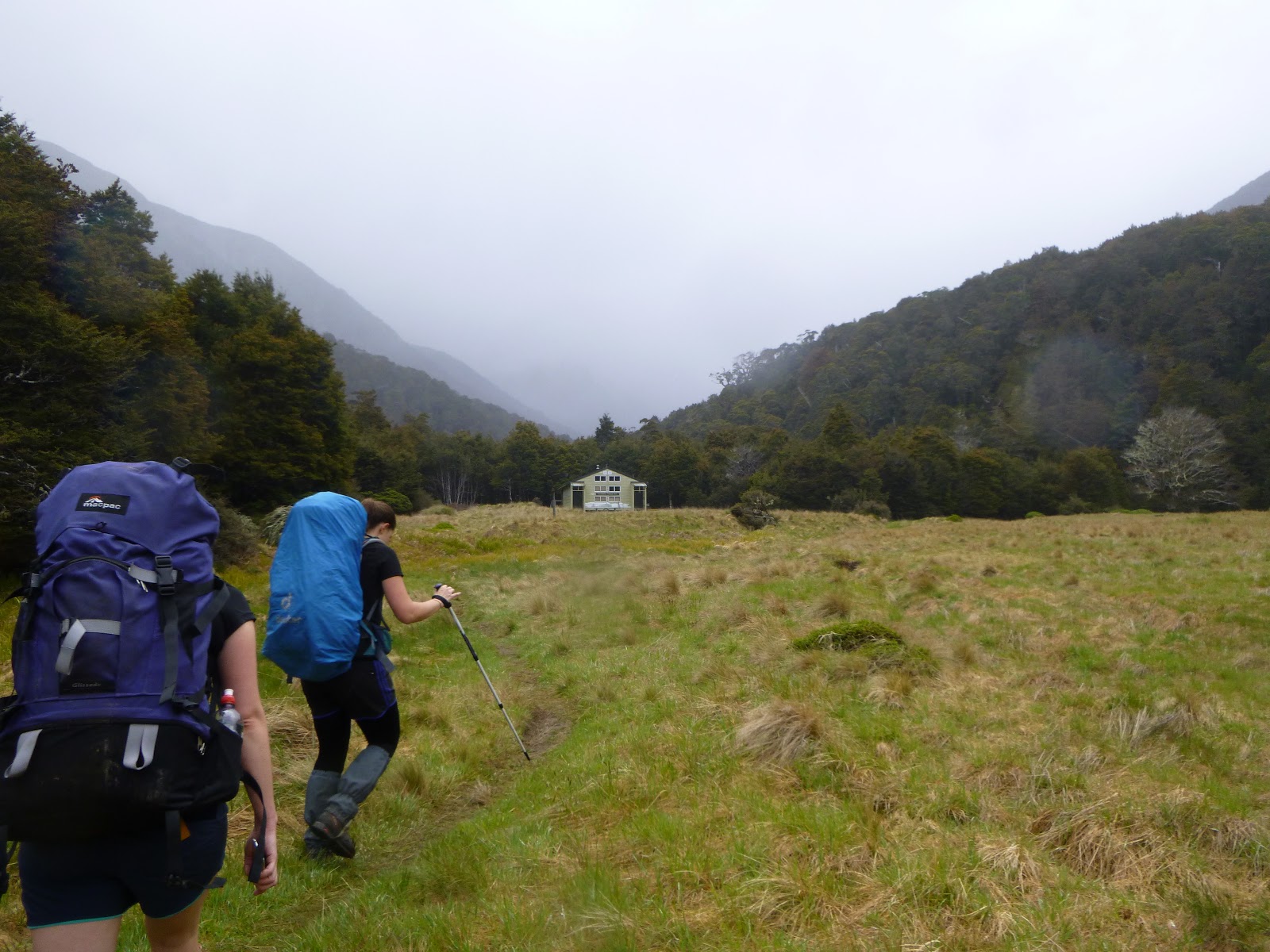
The wander in to Clinton hut was largely smooth sailing. We stopped outside Glade Lodge to remove our jackets, and were the last independent walkers from our boat across the famous swing bridge over the Clinton river. It wasn’t long before we started spotting the robins that became synonymous with our trip. The bush was lush and thick, and we got snippets of view as we walked. Arriving at the hut, we found it only 2/3 full, both of us nabbing bottom bunks in one of the two bunkrooms. We settled in to chill out for the afternoon, reading or doing the jigsaw puzzle laid out in the dining room. It was a bit of a late night, given it didn’t get dark till after lights out and we hadn’t walked far – everyone had loads of energy.
The Praire

Day 2 dawned fine and clear. We ambled off about mid group, stopping regularly (at first) to admire the robins we were seeing along the track. It seemed not long before we reached the lunch shelter used by the guided walkers, where we later discovered we should have topped up our water. It was already getting pretty warm, so we enjoyed a break in the shade before heading off, planning to lunch ourselves at Prairie Shelter.

Prairie Shelter was a roof with no sides. It reflected the heat back in, did nothing to deter the sandflies, and would have been a miserable place to stop in bad weather. While it had a toilet, it had no water supply. It also had a local population of weka, which made the break here a bit more entertaining.

Along the way, at one of the side tracks, we had picked up a wallet accidentally dropped out of a pack. We made an effort to stop at the guided walkers lodge at Pomplona to ensure it wasn’t one of theirs from a previous day (we were confident the current days walkers were all somewhere behind us), before discovering just shy of Mintaro hut that the wallet belonged to a member of a party on our own walking day – good thing too, since it had drivers licences and car keys in it!

A half moments personal reflection was had as we crossed the creek bed immediately past the Guided Walkers Pomplona Lodge – likely the place where the young couple got into trouble a couple of winters ago – to contemplate the crossing of that water course in high flows without a bridge. Crossing it when there was no flow was challenging enough.

Eventually, after being slightly broken by the heat of the day and having run out of water, we made it to Mintaro Hut, where we grabbed a couple of mattresses effectively on the floor and chilled out awaiting a time suitable for cooking dinner, opting not to join several other parties in a mission to the top of the hill to see the views before the weather closed in.

The forecast rain arrived at about 4am, and was soon a steady drizzle. Such an incredible change from the heat of the day before. Suddenly there were thousands of waterfalls visible from the deck of the hut, and we were going up into the clouds and through to the other side in it.

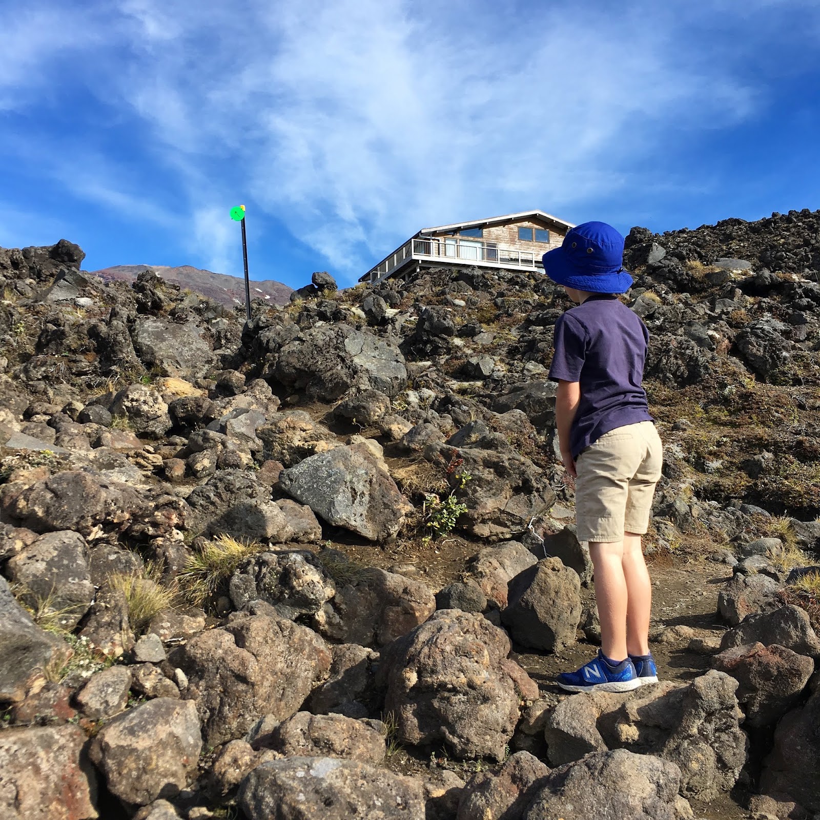
The climb up to Mackinnon Pass was actually almost my favourite part of the trip, despite the weather. The track was well graded, the zig zags enabled good altitude gains while not being too steep, and despite the clouds we got glimpses of amazing views. Cresting out at the top we found the memorial and some tarns, with a bitingly cold wind that had us briefly confer about whether we should stop and put on additional clothing (we opted not to). Mt Balloon and the 12 second drop both kept teasingly peeking out of the cloud before vanishing again, and we spotted a very cold looking weka just as we arrived at the shelter.

Walking into the shelter was like walking into a steam room. Everyone was wet through and sweaty, plus people were (sensibly) taking advantage of the provided gas and water to have hot drinks before heading off again. The toilet with a view had no view to speak of, and one of the girls in another party was struggling with hypothermia (which her party had well under control, utilising group members spare gear and refilling a water bladder with warm water).

Down the hill was a long, slow, cumbersome slog. The track was clear, but not well-formed. There were a lot of unbalanced rocks and huge steps. It had some positives though – Roaring Burn Creek was amazing in the rain, and Andersons Cascade is a massively under-advertised part of the day, especially if it’s been raining.

We finally stopped for lunch at Andersons Cascade shelter, most of the way down the hill. We were eaten alive by sandflies while there, so didn’t stay for long, opting to push on towards Quintin Lodge, where there was another shelter (with a flush toilet and a water boiler). We had decided on our way down that we wouldn’t go out the side track to Sutherland Falls as we were both so tired, but after 20 minutes rest at Quintin, were persuaded by others that we should. We made it to the second swing bridge before deciding we were rather done-in and needed to be aiming for our own hut again.

Not our pack, thank goodness!
Dumpling Hut was a sight for sore feet when we finally got there, although we were far from the last in for the evening. The bunkrooms stank from people hanging their sweaty damp clothes on the bunk ends (to avoid kea predation), despite there being drying racks in the living room. Most people retired early for the night, disbelieving the wardens suggestion on walking times, after all taking significantly longer to get down from the pass than suggested by the previous warden.

Mark and I were the last ones out the next morning, departing as the first guided walkers appeared on the deck in search of toilets. I had massive tendonitis lumps on my Achilles, and so was unable to walk in my boots, instead needing to strap my feet and borrow Mark’s Teva sandals.

Giants Gate Falls
The walk out was odd – I was actively trying to keep my feet dry for starters, and had to be concerned about rocks because kicking one accidentally would have been painful. We ran into Akiko again (a guide for the private walkers, who we had jump-frogged with the day before) a couple of times and she was full of good advice for dealing with the walk out in sandals.

The various waterfalls on the last day of the Milford are lovely, and the track was largely under cover of trees, so not too hot. We made reasonable time, but the last mile seemed interminable. Arriving at Sandfly Point shelter about 5 minutes before the recommended 15-minutes-before-departure of our boat was a relief.

The boat trip back over was incredibly bumpy, as the rivers were up and the tide was moving in, along with the afternoon sea breeze. When we loaded, we had all considered that perhaps opening the blinds would be good to let the breeze in. By the time we were half way back, we were super glad we hadn’t as the spray was huge.

Grabbing a seat in the air conditioned wharf building while we waited for our bus home, Mark whipped up to the café to get ice creams, which were absolute bliss. Thankfully there were only about 6 of us on the bus, so we could put our feet up in preparation for limping off at our accommodation in Te Anau.