Showing posts with label 2010. Show all posts

Monday, 3 January 2011

Hell and Blisters

29-30 December 2010


Jumbo - Powell Loop, Holdsworth Road End, Tararua Forest Park

Party: Mark, Myself

Tuesday and the weather was awful, but predicted to clear for Wednesday and Thursday, so we thought "why not"... And suddenly we had decided that this years summer tramp would be the Jumbo-Powell loop, since Mark was due back on call on the 3rd, and we didnt want to have to go away per se.
Tuesday night we had Mike and Stacey over for dinner while they were both around before dissappearing off to Melbourne for the forseeable future. So after a couple of drinks each and tidying away the dishes, we decided to just go to bed and see how we felt in the morning before we packed.

Wednesday dawned bright and breezy with a few clouds and a continuing good weather forecast online. So we packed up and headed out the door about 10am. Meals had been planned from whatever was in the pantry and lightweight so that we could avoid having to stop at the supermarket. Minimum required gear had been taken. Packs still felt like they weighed a lot.

Arriving at a very busy Holdsworth campsite, and absolutely packed road-end, we were a bit nervous. We were made even more so when we arrived at (the now very different looking) Holdsworth Lodge to discover in the hut book about 14 people indicating they were headed towards Jumbo, possibly for the night. We jotted down our plans anyway and made our way along the Atiwhakatu Valley. At the worst, Mark had a inflatable mat, and I knew there were a few spare mattresses at Jumbo to put on the floor.

Although its not a long walk, the hike along the valley seemed oddly interminable. It just never wanted to fricken end. By the time we got to the hut, I was all for the idea of actually just staying there for the night and not bothering with the rest of the loop. Mark was having none of it, since the weather was meant to be actually nice the next day and it might be the only chance either of us had of doing the crossing with a view.

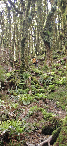
A short way up the spur and I felt a tearing on both my ankles. Oh dear, that felt like blisters. Even more Oh Dear, my heavy-duty, stick-like-anything strapping tape was on the computer table, where it had been deposited after finishing its duty as tape for the injury Mark did to his hand 3 weeks before our wedding. The only thing for it then was to harden up and keep going, which I did.
Going Up
With no small amount of grumbling, by the time the heat and general tiredness made it take us three hours to get to Jumbo Hut, half our precious supply of chocolate was already gone (as were half the cornchips), and we had belatedly realised we had bought no rehydrating powder with us to make up for this distinct lack of sugar.

Dinner was an unusual concoction: Rice cooked in Chicken soup mix with carrot and zuchini, served with cheerios. Yes. That is what we had in the pantry, so thats what we made for dinner. It was actually surprisingly edible. We then finished off the pineapple lumps and snagged a piece of carrot, apple and walnut cake off a fellow tramper who had bought half of said cake with her.

The weather being good, at 8.30pm it was still light, but all 14 people in the hut were obviously used to the idea of having dinner and going to bed soon after, so well before dark everyone was asleep. This led to an interesting occurance of about half the hut residents taking turn about to the bathroom at about 1am.

7am came along with sun shining into my eyes through the hut window. I had slept through sunrise and to be honest didnt really care. The weather report that came at 8 via the warden indicated the weather would be "fine", so packs were shouldered and off up the hill we meandered.
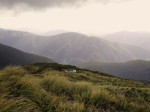
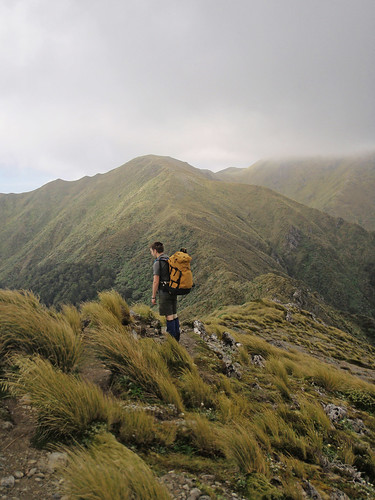
Jumbo Hut On the Ridge

The tops are a lot of up, then down, then up then down, then up then up then up then down. Mark wandered off to the summit of Mt Holdsworth, but I just didnt care by that stage, I was starving for lunch at Powell Hut. Our time across the tops had seen some interesting moments - some boggy areas that didnt have clear paths through them, a freezing cold wind above 1400m and eating most of the last of our snack food - but we made it up, across and down to Powell in 3hours40minutes, which is about the time we expected to take.

After a 45-odd minute stop at Powell for lunch, we struck off back down the track towards Mountain House, the road end and home.We were both tired and hungry (completely out of food and sugar by this stage, bar an emergency packet of two minute noodles), and I was very sore, so the trip was slower than usual. We stopped at Mountain House for nearly 25 minutes, just to rest, and snagged a half biscuit off a lovely couple who stopped there for lunch with their dog.

The track down from here was some of the worst hell I have ever experienced. My blisters hurt, my knees were sore (always are, going downhill), I only had one walking pole (so that slowed me down more than having none, as I couldnt use it the way I wanted - as my downhill brakes) and the bottoms of my feet ached. I am ashamed to admit that it took me nearly 2 hours to get down from Mountain House.

Eventually, though, we made it to the road end. We dumped our packs in the shelter and Mark went and moved the car to it so we could both use the toilet there and get changed at the same time without having to shoulder packs again. Our first stop on the way home was the dairy in Carterton for icecreams and powerade. Next stop was immediately to my parents place for dinner. I was so thrilled to not have to cook.

Monday, 1 November 2010

Getting a Roasting

Saturday 16 October 2010

Whakapapaiti Hut Loop, Bruce Road, Tongariro National Park

Team: John, Mark, Amelia

To be honest, the weather report for the weekend was not pleasant in outlook. Mark and I headed to the railway station weighed down with warm clothing, anticipating bad weather and a weekend spent holed up in the hut (with a possible drive to Tokaanu for the hot pools on Saturday if the weather was really bad).

The lodge was nearly empty. Our group of three plus Andrew for Saturday night, and Richards group of 4 plus a skier for Friday night. In a 32 bed lodge. You could totally tell that it was nearly the end of the winter season and the snow had been fairly average all year!

Saturday morning dawned fairly clear. There was definitely some cloud at lower levels, but up on the skifield the sun was shining. Our original plan had been to get dropped off at the Mangatepopo Road end and walk back to Whakapapa Village, where Richards group would leave the van. Discussions with people who had done that walk indicated that the track was not overly well maintained, and would be nearly impassable due to bogs after any stretch of bad weather. Which the mountain had definitely seen in the week before we arrived.

A plan was instead hatched to attack another portion of the “round-the-mountain” track, which we could clearly see from the large west-facing window of the lodge. There were two ways to get to it: The orthodox way where we either got dropped a few hundred meters down the road or walked the same, or the tramping-club way where we tried to find the most direct route to the piece of track we could see and did some exploring.

Given the walk was only meant to take about 4 hours or so (especially since we were doing it in the down-hill direction), we decided to go with the slightly more navigation-based walk. After a leisurely preparation, and having made lunch, we struck off at about 10am straight towards the Manawatu Lodge.

The walk down to the track did include some interesting moments of navigation – like when we found ourselves at the top of a bluff that we couldn’t tell the size of. Thankfully all three of us are regular trampers and comfortable with route finding, because there were times when we needed three sets of eyes hunting out an alternative path! There were only a couple of occasions when we needed to do any back-tracking, and when we did it was only a few metres at a time.
After about 45 minutes, we started finding marker poles. Some of these did not seem to mark track at all as there was nothing around them. Eventually we did find the track and we started making even better time. The track through this part was well graded, and the “steep-looking” uphill I had worried about turned out to be an easy stroll.

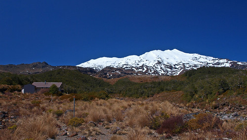
Once at the top, it was a fairly steep drop down into the next valley towards Whakapapaiti Hut. Arriving on the deck of the hut at just on Noon, we decided that this was definitely a great place to have lunch. Sitting in the shade, looking out and up to Ruapehu, I cant think of anywhere better to be on a sunny day. We took a leisurely lunch break of about 45 minutes before heading off down the valley further to complete our walk.
Whakapapaiti Hut

The track between the hut and Whakapapa village is a little odd.
For example:
  • There is a major river that needs to be crossed. In one location this requires actually entering the river in order to cross. Further downstream, a bridge is provided
  • There are areas where the track is exceedingly well maintained – boardwalks and all – and then within moments, you can be in an area where it looks like no track maintenance has ever occurred.
  • Some of the signs are obviously fairly new – the well-recognised DoC-style green and yellow signs. Others are really old.
Overall, it is not an overly difficult piece of track. The river crossing could be tough on people who aren’t confident with it, or if the weather has been bad and the river is up. In cold or snowy conditions, or with strong winds, I wouldn’t do the walk. It is very exposed, and if already cold, the river crossing is still 2 hours from the road. In fact, in winter, I would be keen to go to the hut, but from the upper access only I think. It is well poled for the snow it obviously receives on a regular basis, although some of those poles were falling over a bit – we made sure we straightened and firmed up the support on any we could while there.

Eventually, through the heat, I ran out of water. It was a swelteringly hot day on the mountain. Worse, once we got down to the lower parts of the track nearer the village, the breeze disappeared. And I had brought no t-shirt or similar, so was stuck wearing a superfine merino top that is designed for keeping warm!

Needless to say, we were all glad to see the road end and the camp store selling ice-creams. Once we had stopped here to eat them, it was time to wander down to the Tama Lakes carpark to pick up the club van and return ourselves to the lodge for some relaxing and dinner.
The sun was streaming into the lodge when we arrived home, and after a relaxing (and long by lodge standards – but there was no one else wanting one, and heaps of water in the tanks) shower, it was great to sit in the lounge in the warmth and read a book to relax before dinner. It was only when I went out to the bunkrooms for something that I realised just how warm the lounge really was. And it took stepping outside for sunset photos to realise that opening the windows to cool the lounge off would be a really bad idea (it was freezing. The wind we had been expecting all day had arrived and it was bitterly cold!).

After an early night (by lodge standards at least) of about 9pm, we woke Sunday morning to clag. At times the clag was so thick we could barely see the neighbouring lodge. Needless to say, the radio stations were reporting that the mountain was closed due to combined poor visibility and wind. We spend the morning fluffing about, relaxing and reading books before cleaning up, grabbing some lunch and heading off around the mountain to the Desert Road to collect Richards tramping group, who had taken half the DoC suggested time to get out from their overnight accommodation at Otarere Hut and so had been waiting in the rain for us for an hour.

Then it was time to head home, via a stop in Taihape for coffee and another in Bulls for Dutch Licorice.
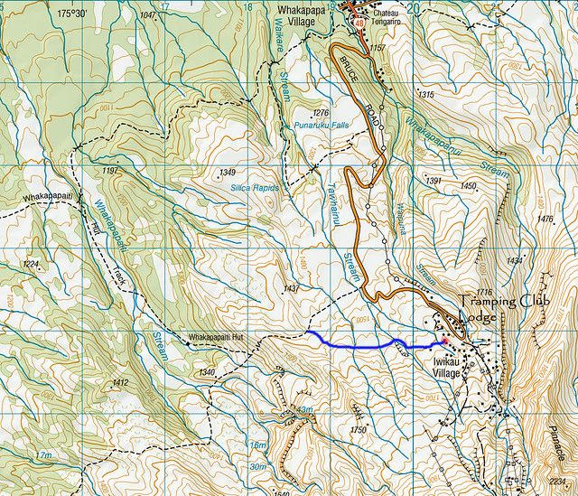
BJ34_Mount Ruapehu_1-00
The red dot is roughly where the club lodge is based.
The blue line is a rough guess as to where our navigation took us before joining the track and heading to Whakapapaiti Hut and the Whakapapa Village

Tuesday, 3 August 2010

Hot Days Peddling

Rimutaka Incline Rail Trail, Hutt Valley

February 6, 2010

Mark and I

Mark and I had decided it was time for a new form of adventure, so we bought a mountain bike for me so we could go for bike rides together. Our first trip out was the Rimutaka Incline, just beyond Upper Hutt. Since we only had our car, we decided we would cycle in from the Upper Hutt end, have lunch at Summit Station and ride back.

It was a gloriously hot and sunny Saturday, as is fairly common for Waitangi Day in Wellington (2011 proved the exception to the rule), when we packed up the car with our two bikes, lunch and water and headed off. The carpark was already busy when we got there at 10am, but we snagged a spot in the shade, got ourselves sorted out and headed off.

The track was a bit deceiving – it appeared to be almost completely flat but wasn’t. So I was riding with my bike in quite a heavy gear because anything less felt like I wasn’t getting anywhere. Needless to say, I got most of the way to the end and was exhausted. I also was wearing my usual running shorts which had no extra padding, and wound up with an exceedingly sore bum – so I walked a lot of the last 1/2km.


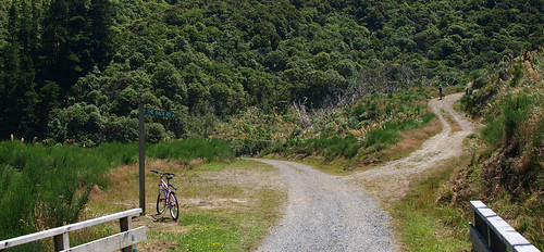
I'll take the back road

The track is well formed and easy riding the whole way up to Summit. It was more than wide enough to ride two abreast most of the way, and still allow space for someone coming down the hill to go past. The biggest issue we found was getting our bikes around the barriers – considering its sold as a good walking track as well, you wouldn’t want to be taking a kid in a pushchair through there without help to get them over these!

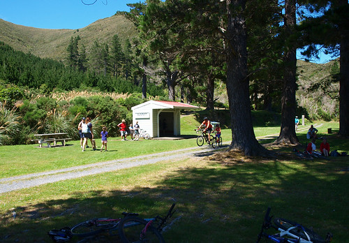
Summit Station

Once at the top we dropped our bikes and ourselves in a nice spot of shade and thoroughly enjoyed the miniscule wisps of breeze that deigned to come through to cool us off. Apparently it’s an exceedingly rare occurance for it to be that still at the Summit. After a simple lunch of sandwiches and fruit, it was back on the bike – using my towel as extra cushioning on the bike seat so I could handle sitting! It was on the way downhill that I finally realised just how much of a climb I had completed on the way up, as I flew down the hill (a LOT of fun) at a pace that was also comfortable, not requiring extending pulls on the brakes as the incline was solid but not steep.

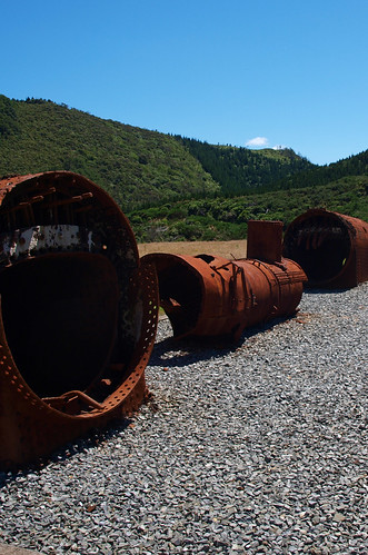
The old stuff

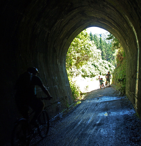
We didn’t stop much on the way down the hill, except to play with a long exposure photo in one of the tunnels. We did decide that at some stage in the future we really needed to come back and do the entire crossing, since I had been too sore to even walk down the Wairarapa side to the long tunnel and steep section.

Tunnelling

Arriving back at the car we saw that oops, the shade we had parked in had vanished, the car was drenched in sunshine and about 40degrees inside.

So, final thoughts? All in all a good wee track. Definitely on the must do again at earliest possible convenience list.

Thursday, 10 June 2010

Wet concrete and a good fall

5 - 6 June 2010

Totara Flats Hut, Waiohine Gorge Road End, Tararua Forest Park

Party: Myself, Mark

Queens Birthday long weekend, 6 weeks of unemployment for me, and a variable, but not BAD weather forecast saw Mark and I getting up at a reasonable time on Saturday to head for the hills for a night, just to get away.

Our original plan had been to complete the Jumbo - Holdsworth circuit, but the weather report indicated that the best way to do this would have been to complete the tops on Saturday and be on our way out on Sunday, which would have been do-able, but we didnt feel like the early start that would require!Instead we decided on Totara Flats Hut, somewhere neither of us had been before, and therefore another hut to cross off our list - sweet - and a reasonably flat tramp to a reasonably large hut, so hopefully not too hard (since I havent tramped since Easter), and fingers crossed not a full hut!

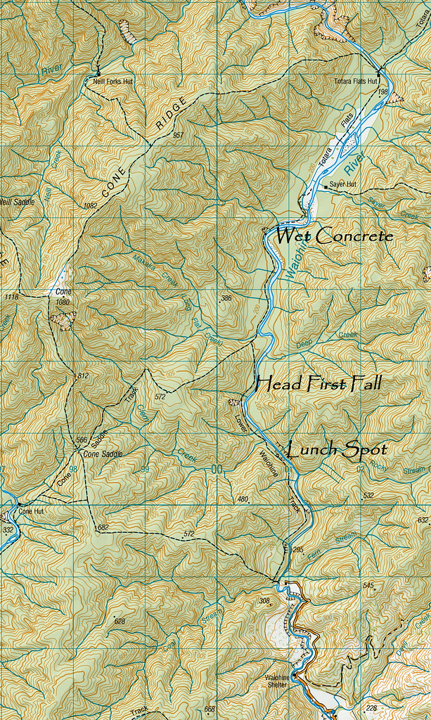
Reading up the information we could find, all indications were it would take about 3.5 hours, so we allowed for over 4 hours of afternoon daylight and left the road end at about 12.30. An hour later, we rounded a corner to a spot that looked like it would be great for lunch to find it already occupied - by Megan S from club, and a friend of hers! Small world!

A quick lunch was had and we continued on, reaching Clem Creek after only a short stint. It wasnt too bad to cross, but getting down to it and back up again was a challenge, as access was very steep. In very bad weather, it would be impassable, and so we had a very brief discussion here about returning to the car, given the weather report. We decided to press on and hope that the weather report was right, and only light rain came through overnight and on Sunday morning.
There wasnt much memorable along the next part of the track, until the point where we first came down to nearly river level. This involved a short clamber down a slightly slippery tree root "ladder", and after one good step I lost my footing and started falling headfirst down the bank! I had enough time to realise that this was NOT a good place to do this (just on 3 hours from the road end, and we believed about 45 minutes from the hut), before I landed somehow feet first, jarring my neck a little and rattling my teeth together, Marks hand wrapped tightly around my upper arm, where a long graze and large bruise was already showing. (Photo taken later that evening at the hut, where the bruising is starting to become evident under the graze. This later turned black, then deep green for a couple of days, before fading within 10)
Thank god I landed feet first and not head first... Sunday night at home I kept having nightmares of the fall, and the aftermath if I had landed badly - pitching tent on a narrow bit of track, having to send the next people through back to the road for help (we knew they were there), a helicopter ride back to town, ringing my parents with the news...

At this point we could see river flats ahead, and instead of pulling out the map, we assumed that these were the last flats before the hut, meaning the hut should be about 2km along the valley - perhaps 45 minutes. So I put on a thermal top to limit shock and we kept going. My first aid kit was somewhere in my pack, and when a moments rumaging didnt dislodge it, I gave up on finding a bandage and pain killers in preference for moving on towards the hut.

A short way further on was a decision point: The high-river track or the river-side track? The river was low, so we took the river-side option and clambered down the rocks to it. Ambling along the riverbed, we suddenly found ourselves starting to sink into concrete-like mud with every step! Looking away from the river, we saw the obvious scars of a fresh slip (Megan said later it must have been that week because DoC didnt know about it). We were about halfway between the river and the bank, and so wound up with no option but to start running from large rock to large rock across the face of the slip until we got to the other side and out of the quick-sand cement!

Going in to Totara Flats from here there is a LARGE orange triangle that marks what is obviously a track people have created by trying to get back to the track from this marker, as at that point it is not at all obvious that there is another route back to the track. There is, however, a much easier track to get back on to the main track about 20m or so beyond this marker triangle. Trust me on that one.

At this point we thought "yay, we MUST be nearly there". Not quite. We were back in to bush and climbing away from the river again... So once at the top, the map came back out and we realised that only now were we at the point we thought we had been at over an hour earlier. Getting across the bottom of the slip had taken quite a while. It was well on to 4.15 and we were down to less than an hour of daylight left. By all accounts, we should have already been at the hut by now, and the map indicated another 2km to go!

The stomp down the valley across the plain was slow and tedious going, and by the time we reached the bushes near the hut, it was dark enough that we pulled out my head torch to light the way. Arriving at the hut in the just-darkness at 5.15 we were exhausted, having taken over an hour longer than we had anticipated (4hr 45 min as opposed to 3hr 30min). AND we were worried, as we knew there were two other parties a good distance behind us in the dark.
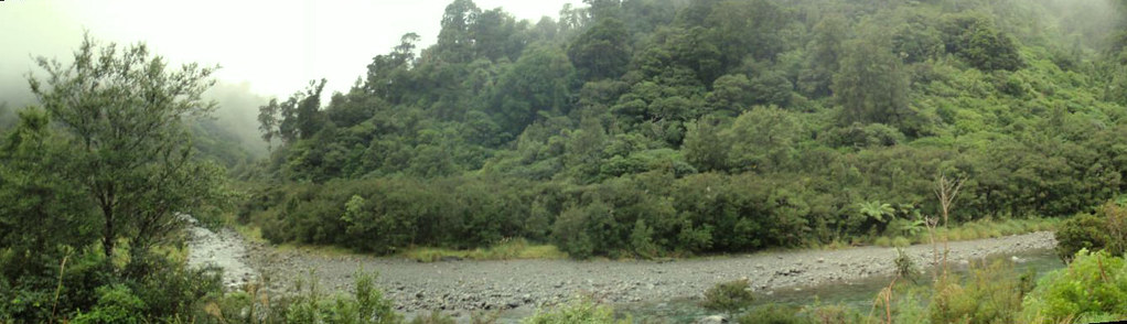
Totara Flats panorama

At 6.30, the group of 4 girls who had left the road end at the same time as us arrived, reporting that they had last seen Megan and Ruth at the river more than an hour previous, as the light was fading. Megan and Ruth finally stumbled into the hut at 7.30pm, having been walking in full darkness for 2 hours, including some interestingly steep scrambling, and having had difficulties finding their way off the river in the gloaming.

Dinner was a yummy rice risotto with canned chicken and carrot, followed by steamed pudding for dessert! Then after re-dressing my graze, and taking a couple of painkillers it was off to bed fairly early. Every time I rolled over I woke up because that arm was dead, and I had to consider my sleeping position carefully to ensure minimal pain...

At some stage overnight it started raining. Just a steady drizzle, rather than an intense downpour. So we were out the door not long after 8.30am, aiming to get back past Clem Creek before the rain got any heavier and caused any issues with crossing. Thankfully it did. Getting across the slip was easier on the way back too, as we stayed closer to the river, where the mud was less sticky. Another group went the long way around the top of the slip and found it only just passable.
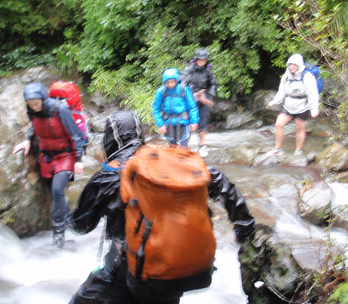
Clem Creek was up, but only by about 5cm or so, and crossing it was made more fun by having 10 of the 12 of us coming out that way all arrive there within a few minutes of each other, and therefore crossing together.River Crossing

The road end was reached in just on 4 hours, with only about 5 minutes of stops (apart from the 10 minutes it took to get everyone across the creek), with the party of 4 leaving the carpark as we arrived, and the four girls arriving at the shelter as we were re-packing to leave.

Pizza and Chips at the White Swan for lunch was the next order of business, and this attended to, it was time to go home!
Totara Flats Tramp

Friday, 9 April 2010

Last of the summer sun

Easter (01-05 April) 2010

Sabine Valley, Nelson Lakes National Park

Team: Me, Mark, Karl, Craig, Mike, Barbara (with appearances by many other members of the club!)

Thursday

Thursday afternoon saw me finishing work early and wandering around the waterfront to meet my Dad, who had offered to drop Mark and I off at the ferry terminal for our sailing. Once sorted into the vans, we hung around for a while waiting to be loaded onto the ferry for the journey south.
Pretty much everyone in my group had brought their own dinner rather than buy on the ferry, and some of the food was pretty incredible! I had a Chicken Salad Sandwich and had brought half a banana cake (leftover from a leaving morning tea earlier in the week) to share, while Karl and Craig had fantastic looking bacon salad sandwiches! Yum! During the sailing, the ferry lost its computer service, and so for a while there was a massive queue for hot food because they couldnt serve anyone. Eventually they started letting people have the food for nothing since it was a dinner time sailing and a lot of people obviously had no other food with them!

Eventually we arrived in Picton and drove on to St Arnaud, our stop for the night. The campground there is lovely, and has HOT showers! (pay at the DoC office if not staying in the campsite already). It was actually quite warm considering how cold it had been at the road end a month earlier! I was prepared for it to be freezing, and instead we all actually commented on how warm we were, which was nice!
Friday

The other two club groups were heading off from St Arnaud directly, while we were heading around to Lake Rotoroa to start our tramp. Given that all the groups were ending up back at Rotoroa and we had two people willing to drive club vans, we took both vans around to the other lake on Friday morning to start our trip
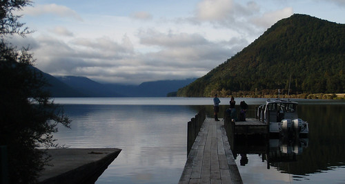
Rotoroa
There was another group on our water-taxi as well, who were walking in the D'Urville valley, so we dropped them off first at D'Urville Hut
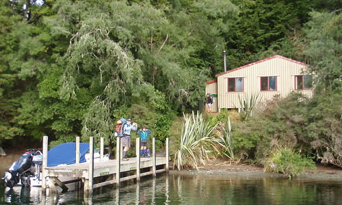
D'Urville Hut
Before heading over to Sabine Hut, where we would start from.

After an obligatory group photo before departing on our walk, it was time to get moving! The weather was lovely and warm, and we knew we didnt have too far to go (only about 5.5 hours or so) and so we took our time, stopping regularly for breaks, including at a really awesome bridge over a really deep gorge. We were only about 40 minutes from the hut, but damn we all wanted to go for a swim!
The walk up valley progressed largely as expected. There was still a lot of visible tree-fall from the really heavy snow of two winters ago, and some of this was quite tricky to navigate. There was also a lot more up and down than was visible on the map!
We stopped for lunch in a lovely little spot with a view over the river, just beyond a small stream crossing, which was about the first time we had to get our feet wet. Soon after this, at a really narrow piece of track, my pack made a bid for freedom towards the bank, and nearly took me with it. Soon after this I wound up in so much pain I could barely walk - it appeared I had pinged something in my back! Bummer!
We knew that we were more than halfway though, and so decided to continue on, because in this case, the Devil we didnt know was more appealing than the devil we did, and a rest day was available the next day anyway. I had to continue carrying all my own gear though, as no-one had enough space in their packs to take anything off me! (the joys of being on day one of four!)
By the time I got to the hut, I had been "on the move" for the better part of seven hours, and never before have I been quite so grateful to find a hut with bottom bunk space available!

Dinner that night was a scrummy pasta with veges and tomato pesto, followed by what should have been instant pudding, but we didnt bring enough milk powder, so it still wasnt really edible - we contented ourselves with eating marshmallows instead! After such a long-seeming day, we were all in bed by 9pm, which was great!

Saturday

Saturday morning Barbara and I relaxed for a day of rest. Me for my back, Barbara because she was on holiday and didnt feel like going anywhere! The boys all headed off to Blue Lake Hut for a daywalk, although Karl came back within about half an hour because he was getting pain in the back of his foot.
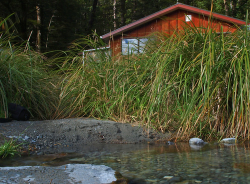
West Sabine
So our lazy day consisted of not going much further from the hut than the toilet, except Karl, who spent most of the day getting in and chopping more firewood for whoever was there next. Thoughtful chap, that Karl, must remember to tell his parents that at some stage...
Other parties eventually started to trickle in, including our intrepid boys and the Medium group who had come over the saddle, all arriving about 4.30pm.
After some obligatory shots of dinner preparation, it was time to eat at about 6.30. Our group had vegetarian rice risotto, followed by an awesome camp cheesecake. There were NO leftovers...
Dessert
Eventually it was off to bed, not too late in the end because everyone was fairly tired.

Sunday

After a slightly lazy start, we were off towards Sabine Hut again by about 8.30am, figuring it would be nice to get there for a late lunch since the weather was meant to turn nasty at some stage that day. It was cloudy, and miserable looking.
Our times were substantially better getting to anywhere on the way back to Sabine than they had been on the way out, mainly because we were stopping less often because the weather wasnt so nice!
In the end, we managed to make it back to Sabine Hut dry (having seen only some very light drizzle) and in time for a late lunch at about 2pm.
The other group werent far behind us, and once they arrived, most people headed down into the lake for a dip. It wasnt too cold, but the bottom of the lake was covered in some awful gunk that was spread everywhere when anyone stood on it. Needless to say, most of us didnt stay in there very long!
A lazy afternoon in the hut followed, with many games of 500 played before a fairly early dinner due to daylight savings having changed that morning (it got really dark, really quickly!). We had vegetable couscous, followed by chocolate biscuits for dessert, and yet again what looked like heaps of food dissapeared rather quickly!
The personal fight was to stay up until 9pm, since it was dark at about 6. Most people managed, but pretty much everyone was in bed by 9.30pm.

Monday

Another lazy, nothing day. No one really felt like doing anything, so we sat around the hut and played cards, and cleaned up. Barbara and Mike went with Clintons group on an earlier water taxi so that the vans were evenly packed, and the rest of us waited for our pickup with Pauls group after lunch.
The weather turned cold as soon as we got to St Arnaud, and only half the showers actually had hot water in them, which sucked (I got a cold one!). From there, after a short stop at the shop to get cake and coffee, it was straight back to Picton and into the queue for the ferry. Dinner was a greasy and great Chicken burger and fries, HUGE.

Monday, 8 March 2010

Feeling HOT HOT HOT!!

February 26-28 2010

Lake Chalice, Mt Richmond Forest Park, Staircase Road End

Team: Me, Karl, Ian, Olivia, Valentina

Photos are a little different this time, they are low-res versions uploaded directly, as I have yet to post any shots to flickr to have links... This might be remedied later, but for now, we'll see!

Friday night saw an unusual start to a tramp for me - catching the bus along the Old Hutt Road to walk over the bridge to the ferry terminal. After a few nervous moments, waiting for everyone to arrive, we were all there and checked in. Dinner was had on the ferry, and I have to say that the Lasagne wasnt actually too bad, although I wish I had brought dinner stuff like Olivia did - that looked fantastic!

We then collected a rental and drove off into the dark, heading for a campsite at a much easier to find road end. It was fairly cold overnight, and most people didnt sleep particularly well I gathered, and we were all glad for some hot water at breakfast time!

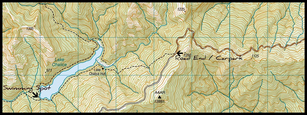
Once the tent had gotten some sunshine, and our condensation-damp sleeping bags had spent some time in the sunshine drying off, we packed up and headed back down the road in search of our actual road end. It was a nightmare to get to, and I am VERY glad we didnt do it in the middle of the night (plus there was nowhere suitable to camp AT the road end anyway!)

From there it was down the hill (and a steep b*&ch of a hill it was!) to the hut for lunch. After a suitable rest period of about an hour, we packed up day packs and headed off around the lake, which was estimated to take about an hour. The lake was very low, and it was very hot, so we were immensely grateful to find that at the far end of the lake it is entirely possible to get down from the track to a small beach-like area where we paddled our feet, and sank in the mud. It was so refreshing no one really wanted to leave, but it was also SO hot, and there was no shade, so we were all feeling the heat a bit!

We headed around the far side of the lake, already having decided that perhaps walking up a spur and on to the tops in this weather was a bit foolhardy, as we were all feeling rather tired from the heat. This was a great decision, as once we got to where the spur we were planning to follow went, we discovered it was bluffs at the track level, and so would have been a tad tough to get up!


Eventually we got back to the hut. Well, it felt like eventually, as the heat made everything seem like it took a lot longer than normal! In fact, we had only taken just over three hours to get around the lake, which was about on DoC time of 2.5 hours, plus our half hour lounging about in the lake!.


The rest of the afternoon was given over to rest. Pretty much everyone had a nap, although I decided not to as I didnt think I would wake up in time to get dinner going if I did! Plus I was feeling dehydrated, so I figured sitting around reading and re-hydrating was possibly more important than napping!


Soon enough it was time to start dinner, which was a bacon risotto followed by apple crumble. It went down a treat, and all of a sudden it was 9.30pm and everyone was getting ready for bed! I think because the hut stayed fairly light for ages, being in a nice sized clearing and with good weather, we must not have started dinner quite as early as previous trips. The cards didnt even come out before people headed to bed!


Sunday morning we were up slightly earlier than Saturday, as we were unsure how long it would take to get back up to the road end, and drive back to Picton. Our aim was to get to Picton by just on 1pm (at the latest) to allow us time for lunch before our ferry. Out of the hut at just on 8am, we were at the road end by just after 9am.

Even with a stop at the lookout, and cruising our way down the nasty road, then stopping at the actual road turn-off, we were still in Picton at just after 11am! We split up and all headed off to have lunch wherever we felt like it, planning to come back to the car at 12.15pm.
While at lunch, I got a text from Jackie (our weekend contact) telling us that there was a Tsunami warning, but the ferries didnt seem to be affected. This was good news, we guessed.
We also decided to see about getting on the 1.10pm ferry instead of the 2.25pm one, which we managed, and that was great, as the ferries were being diverted away from Tory Channel and out past Ship Cove instead, adding an hour each way. So we got home at about 5pm, which was nice for a change for a South Island trip - still enough time to go home and unpack before collapsing in to bed...
Lake Chalice Tramp

Wednesday, 6 January 2010

So much for 5 days...


Our plan for the summer break from Christmas to New Years this year had been ambitious. Too ambitious, the weather gods decided!


Original Plan

Day One - Holdsworth Road end to Jumbo Hut via Atiwhakatu Hut and Raingauge Spur

Day Two - Jumbo Hut to Mid Waiohine Hut via Mt Holdsworth Summit

Day Three - Mid Waiohine Hut to Maungahuka Hut via Aokaparangi Biv

Day Four - Maungahuka Hut to Totara Flats Hut via Neill Forks Hut, with possible detour to Tararua Ladder

Day Five - Totara Flats Hut to Waiohine Gorge Road End

So, it rained, or blew gale force winds the whole period between Christmas and the return to work...


New Plan

Head to Ohakune for a couple of nights and see about fitting in the Tongariro Crossing, plus a couple of day walks (hopefully beating the bad weather to that part of the country) and then head to the beach, hope the weather clears and go into the Tararuas later in the holiday break...

Well. We didnt beat the weather.

We set up our tents in Ohakune in hot, sticky and claggy weather mid afternoon, wandering off to the supermarket in shorts and t-shirt, almost hoping it would rain on us without our umbrella or raincoat. It didnt. After picking up the bits and pieces we needed for the next couple of days, we started looking into options for doing the Tongariro Crossing - debating the merits of taking our own car around and getting a one way shuttle, then heading to Tokaanu for the hot pools, or just getting the shuttle both ways.
Given that going to Tokaanu would quite possibly have had us back in Ohakune so late that we would have had to go to Waiouru for dinner (everything closes at about 8pm in summer), we decided to do a return shuttle. The company we wanted to book with said they werent planning on going the next day because the weather was going to be too bad, but to call them after 6.30 the next morning to reconfirm.
I admit, I went to bed sort-of hoping that when we rang at that ungodly hour they would say the weather was still going to be too bad, and I could go back to sleep for a while longer, but they didnt. Instead, we were told we had 30 minutes to get organised and be outside the campground for pickup. Cue rushed bolting down of half-sized bowls of porridge and quick filling of waterbottles and being thankful that we had made lunch the night before!
The weather was looking pretty nasty, and was on the edge of being bad enough that the shuttles wouldnt go, but we went on anyway, being dropped at the road end unable to see anything up the valley. It did not look much like it was going to be fun.
The weather stayed bad all the way up to Soda Springs, where most of the others in our shuttle were stopping to have the breakfast they had not had time to have before they left. Under my raincoat, I changed clothes at least once along here, swapping my warm thermaplus for a running top since it was quite muggy. I was really glad of this all the way up the devils staircase. I was also really glad to not be able to see the top as we were climbing up, as I really just wanted to stop and go back for most of the climb!
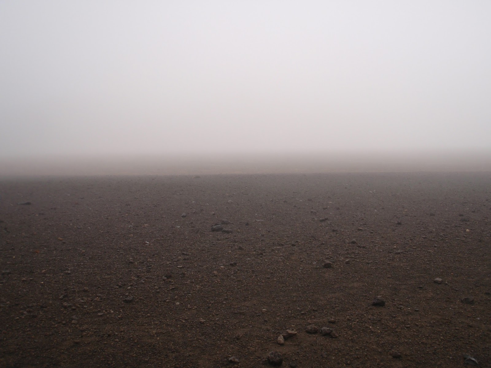
Once in south crater, the cloud clagged in even further. There had also been quite a bit of rain as there were some large puddles around. Interestingly, it was better to walk in the middle of them, where the ground was still solid with a layer of water on the top, than around the edges, where it had become mud. Once at the turn-off for the Tongariro Summit, we saw a brief couple of moments of sun, but Red Crater was still largely hidden, even when standing on the edge of it!
The drop down to the emerald lakes was longer than I remembered, and I was glad of the bad weather putting so many people off, so I didnt have to weave among slower walkers. When we got down there, we stopped for a museli bar each, and I changed back into my warmer thermaplus, as the wind was getting quite strong and cold on my now-soaked-to-skin body.
Beyond blue lake is the cairn valley, very cool and very odd. The zigzags down to Ketetahi Hut weren't as bad as I remember, although this could be because we couldn't see the hut, so there was no agonising "Oh my god, another zig zag." or thinking of dropping down the ridge direct to the hut. We had lunch on the deck in occassional sunshine, which was lovely and then missioned our way out the last of the track in time for a 4pm shuttle, as did all but one other couple from our morning shuttle.
I was very sore in the backs of my knees after the tramp, with an awful burning sensation. We discovered that I was badly windburnt when we had a bath at the campground. It certainly made for an interesting night in a little tramping tent, especially when I had to get up and go the toilet at 3am and had to crawl, crying, out of the tent!
It started raining heavily overnight, and we packed up the tent wet, quite early, keen to get to the beach house, real beds and the care of my Mum for my legs! Mark drove because the pain was so distracting. We stopped briefly at Te Apiti windfarm, and then again in Woodville for cheesecake and toilets, but other than that, it was pretty much straight through, arriving at the beach early enough for us to peg the tents flat to the ground in the gale force winds and sunshine and watch them take 30 minutes to dry!
So, we didnt even look at the Tararuas! By the time my legs had recouperated and I could walk properly again, it was time to go home and get ready to go back to work! (they are still peeling in places though!) In any case, the Tararuas had had nearly half a meter of rain over 6 days while we were away, along with low cloud and gale force winds. It really wouldnt have been a nice time to be in there. I'm still dissapointed at missing all those new huts - but now I'll just have to go later instead!
Photos to come (written at work, all the photos are still on the computer at home!)